Filters
Date Range
Extensions
Types
Contacts
Categories
Tag Types
Tag Schemes
|

This map layer consists of federally owned or administered lands of the United States, Puerto Rico, and the U.S. Virgin Islands. For the most part, only areas of 320 acres or more are included; some smaller areas deemed to be important or significant are also included. There may be private inholdings within the boundaries of Federal lands in this map layer. Some established Federal lands which are larger than 320 acres are not included in this map layer, because their boundaries were not available from the owning or administering agency.
Tags: Air Force,
Alabama,
Alaska,
Arizona,
Arkansas, All tags...
Army,
BIA,
BLM,
BOR,
Bureau of Indian Affairs,
Bureau of Land Management,
Bureau of Reclamation,
California,
Coast Guard,
Colorado,
Connecticut,
Coordinated Area,
DHS,
DOC,
DOD,
DOE,
DOJ,
DOL,
DOT,
Delaware,
Department of Commerce,
Department of Defense,
Department of Energy,
Department of Health and Human Services,
Department of Homeland Security,
Department of Justice,
Department of Labor,
Department of Transportation,
Department of Veterans Affairs,
District of Columbia,
Downloadable Data,
Downloadable Data,
Experimental Range,
Experimental Station,
FS,
FWS,
Federal Center,
Federal Correctional Complex,
Federal Penitentiary,
Federal lands,
Field Site,
FileGDB 10.1,
FileGDB 10.1,
Fish and Wildlife Service,
Flight Center,
Florida,
Forest Service,
GSA,
General Services Administration,
Georgia,
HHS,
Hawaii,
Idaho,
Illinois,
Indian Reservation,
Indiana,
Iowa,
Job Corps Center,
Kansas,
Kentucky,
Law Enforcement Training Center,
Louisiana,
MWAA,
MWAA,
Maine,
Marine Corps,
Maryland,
Massachusetts,
Metropolitan Washington Airports Authority,
Michigan,
Minnesota,
Mississippi,
Missouri,
Montana,
NASA,
NIH,
NPS,
National,
National,
National Aeronautics and Space Administration,
National Battlefield,
National Cemetery,
National Conservation Area,
National Fish Hatchery,
National Forest,
National Game Preserve,
National Grassland,
National Guard,
National Historic Park,
National Historic Reserve,
National Historic Site,
National Institutes of Health,
National Laboratory,
National Lakeshore,
National Memorial,
National Military Park,
National Monument,
National Natural Landmark,
National Park,
National Park Service,
National Parkway,
National Preserve,
National Recreation Area,
National Reserve,
National Scenic Area,
National Seashore,
National Wild and Scenic River,
National Wilderness Area,
National Wildlife Refuge,
Naval Petroleum Reserve,
Navy,
Nebraska,
Nevada,
New Hampshire,
New Jersey,
New Mexico,
New York,
North Carolina,
North Dakota,
Ohio,
Oklahoma,
Oregon,
Pennsylvania,
Public Domain Land,
Puerto Rico,
Research Facility,
Research Natural Area,
Research Station,
Rhode Island,
Scenic Area,
Small-scale Datasets,
Small-scale Datasets,
Small-scale Datasets,
Small-scale Datasets - Boundaries,
South Carolina,
South Dakota,
Space Center,
TVA,
Tennessee,
Tennessee Valley Authority,
Test Site,
Texas,
U.S. Coast Guard,
U.S. Department of Agriculture,
U.S. Fish and Wildlife Service,
U.S. Forest Service,
U.S. Virgin Islands,
US,
USA,
USDA,
United States,
Utah,
VA,
Vermont,
Virgin Islands,
Virginia,
Washington,
Waterfowl Production Area,
West Virginia,
Wild Horse Range,
Wild and Scenic River,
Wilderness Area,
Wildlife Management Area,
Wisconsin,
Wyoming,
boundaries,
intelligenceMilitary,
society, Fewer tags

Small rock bottom stream Junction of 211 and 785, Roanoke CO., VA
Tags: Corydalidae,
Entire,
Larvae,
Megaloptera,
Nigronia, All tags...
Roanoke County,
VA,
Ventral,
abdomen with 7 or 8 pairs of lateral filaments or gills,
alderflies,
arranged 1 pair on each segment,
dobsonflies,
fishflies,
hellgrammites,
immature,
three pairs of jointed legs present, Fewer tags

This dataset provides timeseries data on water quality and quantity, as collected or computed from outside sources. The format is many tables with one row per time series observation (1 tab-delimited file per site-variable combination, 1 zip file per site). This compilation of data is intended for use in estimating or interpreting metabolism. Sites were included if they met the initial criteria of having at least 100 dissolved oxygen observations and one of the accepted NWIS site types ('ST','ST-CA','ST-DCH','ST-TS', or 'SP'). This dataset is part of a larger data release of metabolism model inputs and outputs for 356 streams and rivers across the United States (https://doi.org/10.5066/F70864KX). The complete release...
Tags: 007,
012,
AK,
AL,
AR, All tags...
Aerobic respiration,
Alabama,
Alaska,
Arkansas,
CA,
CO,
CT,
California,
Carbon,
Carbon dioxide,
Colorado,
Connecticut,
DC,
DE,
Delaware,
Dissolved oxygen,
District of Columbia,
Energy metabolism,
FL,
Florida,
GA,
Gas exchange,
Georgia,
IA,
ID,
IL,
IN,
Idaho,
Illinois,
Indiana,
Iowa,
KS,
KY,
Kansas,
Kentucky,
LA,
Louisiana,
MA,
MD,
ME,
MI,
MN,
MO,
MS,
MT,
Maine,
Maryland,
Massachusetts,
Michigan,
Minnesota,
Mississippi,
Missouri,
Montana,
NC,
ND,
NE,
NJ,
NM,
NY,
Nebraska,
New Jersey,
New Mexico,
New York,
North Carolina,
North Dakota,
OH,
OK,
OR,
Ohio,
Oklahoma,
Oregon,
Oxygen,
PA,
PR,
Pennsylvania,
Photosynthesis,
Primary production,
Puerto Rico,
Rivers,
SC,
SD,
South Carolina,
South Dakota,
Streams,
TN,
TX,
Tennessee,
Texas,
US,
UT,
United States,
Utah,
VA,
Virginia,
WA,
WI,
WV,
WY,
Washington,
Water courses,
West Virginia,
Wisconsin,
Wyoming,
environment,
inlandWaters, Fewer tags
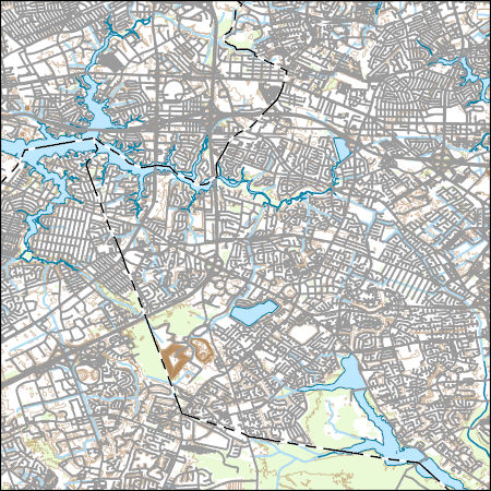
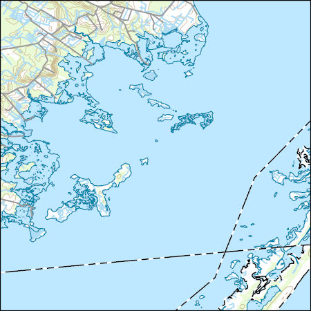
Layers of geospatial data include contours, boundaries, land cover, hydrography, roads, transportation, geographic names, structures, and other selected map features.
Types: Citation;
Tags: 7.5 x 7.5 minute,
7_5_Min,
Chesapeake,
Combined Vector,
Combined Vector, All tags...
Combined Vector,
Downloadable Data,
Esri Shapefile nan,
Norfolk,
Public Land Survey System,
Shapefile,
Topo Map Vector Data,
US,
United States,
VA,
Virginia,
Virginia Beach,
boundary,
contours,
geographic names,
hydrography,
structures,
transportation,
woodland, Fewer tags

The Watershed Boundary Dataset (WBD) is a comprehensive aggregated collection of hydrologic unit data consistent with the national criteria for delineation and resolution. It defines the areal extent of surface water drainage to a point except in coastal or lake front areas where there could be multiple outlets as stated by the "Federal Standards and Procedures for the National Watershed Boundary Dataset (WBD)" "Standard" (https://pubs.usgs.gov/tm/11/a3/). Watershed boundaries are determined solely upon science-based hydrologic principles, not favoring any administrative boundaries or special projects, nor particular program or agency. This dataset represents the hydrologic unit boundaries to the 12-digit (6th level)...
Tags: 10-digit,
12-digit,
14-digit,
16-digit,
2-digit, All tags...
4-digit,
6-digit,
8-digit,
AL,
Abbeville,
Aiken,
Alabama,
Alachua,
Alamance,
Alexander,
Alleghany,
Allendale,
Anderson,
Anson,
Appling,
Appomattox,
Ashe,
Atkinson,
Attala,
Autauga,
Avery,
Bacon,
Baker,
Baldwin,
Bamberg,
Banks,
Barbour,
Barnwell,
Barrow,
Bartow,
Basin,
Bay,
Beaufort,
Bedford,
Ben Hill,
Berkeley,
Berrien,
Bertie,
Bibb,
Bladen,
Bleckley,
Blount,
Botetourt,
Bradford,
Bradley,
Brantley,
Brevard,
Brooks,
Broward,
Brunswick,
Bryan,
Bulloch,
Bullock,
Buncombe,
Burke,
Butler,
Butts,
Cabarrus,
Caldwell,
Calhoun,
Camden,
Campbell,
Candler,
Carroll,
Carteret,
Caswell,
Catawba,
Chambers,
Charleston,
Charlotte,
Charlton,
Chatham,
Chattahoochee,
Chattooga,
Cherokee,
Chesapeake,
Chester,
Chesterfield,
Chickasaw,
Chilton,
Choctaw,
Chowan,
Citrus,
Clarendon,
Clarke,
Clay,
Clayton,
Cleburne,
Cleveland,
Clinch,
Cobb,
Coffee,
Colleton,
Collier,
Colquitt,
Columbia,
Columbus,
Conecuh,
Cook,
Coosa,
Copiah,
Covington,
Coweta,
Craig,
Craven,
Crawford,
Crenshaw,
Crisp,
Cullman,
Cumberland,
Currituck,
Dade,
Dale,
Dallas,
Danville,
Dare,
Darlington,
Davidson,
Davie,
Dawson,
DeKalb,
DeSoto,
Decatur,
Dillon,
Dinwiddie,
Dixie,
Dodge,
Dooly,
Dorchester,
Dougherty,
Douglas,
Downloadable Data,
Duplin,
Durham,
Duval,
Early,
Echols,
Edgecombe,
Edgefield,
Effingham,
Elbert,
Elmore,
Emanuel,
Emporia,
Escambia,
Esri File GeoDatabase 10,
Etowah,
Evans,
FL,
Fairfield,
Fannin,
Fayette,
FileGDB,
Flagler,
Florence,
Florida,
Floyd,
Forrest,
Forsyth,
Franklin,
Fulton,
GA,
Gadsden,
Gaston,
Gates,
Geneva,
George,
Georgetown,
Georgia,
Gilchrist,
Gilmer,
Glades,
Glascock,
Glynn,
Gordon,
Grady,
Granville,
Grayson,
Greene,
Greensville,
Greenville,
Greenwood,
Guilford,
Gulf,
Gwinnett,
HU-2,
HU-2 Region,
HU2_03,
HUC,
Habersham,
Hale,
Halifax,
Hall,
Hamilton,
Hampton,
Hancock,
Haralson,
Hardee,
Harnett,
Harris,
Harrison,
Hart,
Heard,
Henderson,
Hendry,
Henry,
Hernando,
Hertford,
Highlands,
Hillsborough,
Hinds,
Hoke,
Holmes,
Horry,
Houston,
Hyde,
Hydrography,
Hydrologic Unit Code,
Hydrologic Units,
Indian River,
Iredell,
Irwin,
Isle of Wight,
Itawamba,
Jackson,
Jasper,
Jeff Davis,
Jefferson,
Jefferson Davis,
Jenkins,
Johnson,
Johnston,
Jones,
Kemper,
Kershaw,
LA,
Lafayette,
Lake,
Lamar,
Lancaster,
Lanier,
Lauderdale,
Laurens,
Lawrence,
Leake,
Lee,
Lenoir,
Leon,
Levy,
Lexington,
Liberty,
Lincoln,
Long,
Louisiana,
Lowndes,
Lumpkin,
Lunenburg,
MS,
Macon,
Madison,
Manatee,
Marengo,
Marion,
Marlboro,
Marshall,
Martin,
Martinsville,
McCormick,
McDowell,
McDuffie,
McIntosh,
Mecklenburg,
Meriwether,
Miami-Dade,
Miller,
Mississippi,
Mitchell,
Mobile,
Monroe,
Montgomery,
Moore,
Morgan,
Murray,
Muscogee,
NC,
Nash,
Nassau,
National Watershed Boundary Dataset (WBD),
National Watershed Boundary Dataset (WBD),
Neshoba,
New Hanover,
Newberry,
Newton,
North Carolina,
Northampton,
Nottoway,
Noxubee,
Oconee,
Oglethorpe,
Okaloosa,
Okeechobee,
Oktibbeha,
Onslow,
Orange,
Orangeburg,
Osceola,
Palm Beach,
Pamlico,
Pasco,
Pasquotank,
Patrick,
Paulding,
Peach,
Pearl River,
Pender,
Perquimans,
Perry,
Person,
Petersburg,
Pickens,
Pierce,
Pike,
Pinellas,
Pitt,
Pittsylvania,
Polk,
Pontotoc,
Prentiss,
Prince Edward,
Prince George,
Pulaski,
Putnam,
Quitman,
Rabun,
Randolph,
Rankin,
Region,
Richland,
Richmond,
Roanoke,
Robeson,
Rockdale,
Rockingham,
Rowan,
Russell,
Rutherford,
SC,
Salem,
Saluda,
Sampson,
Santa Rosa,
Sarasota,
Schley,
Scotland,
Scott,
Screven,
Seminole,
Shelby,
Simpson,
Smith,
South Carolina,
Southampton,
Spalding,
Spartanburg,
St. Bernard,
St. Clair,
St. Johns,
St. Lucie,
St. Tammany,
Stanly,
Stephens,
Stewart,
Stokes,
Stone,
Sub-basin,
Sub-region,
Subwatershed,
Suffolk,
Sumter,
Surry,
Sussex,
Suwannee,
TN,
Talbot,
Taliaferro,
Talladega,
Tallapoosa,
Tangipahoa,
Tattnall,
Taylor,
Telfair,
Tennessee,
Terrell,
Thomas,
Tift,
Tippah,
Tishomingo,
Toombs,
Towns,
Transylvania,
Treutlen,
Troup,
Turner,
Tuscaloosa,
Twiggs,
Tyrrell,
US,
Union,
United States,
Upson,
VA,
Vance,
Virginia,
Virginia Beach,
Volusia,
WBD,
Wake,
Wakulla,
Walker,
Walthall,
Walton,
Ware,
Warren,
Washington,
Watauga,
Watershed,
Watershed Boundary Dataset,
Wayne,
Webster,
Wheeler,
White,
Whitfield,
Wilcox,
Wilkes,
Wilkinson,
Williamsburg,
Wilson,
Winston,
Worth,
Yadkin,
Yancey,
York,
inlandWaters, Fewer tags

Layers of geospatial data include roads, airports, trails, and railroads.
Tags: Accomack,
Airport Complex,
Airport Point,
Airport Runway,
Airports, All tags...
Airstrips,
Albemarle,
Alexandria,
Alleghany,
Amelia,
Amherst,
Appomattox,
Arlington,
Augusta,
Bath,
Bedford,
Bland,
Botetourt,
Bristol,
Brunswick,
Buchanan,
Buckingham,
Buena Vista,
Campbell,
Caroline,
Carroll,
Charles City,
Charlotte,
Charlottesville,
Chesapeake,
Chesterfield,
Clarke,
Colonial Heights,
Covington,
Craig,
Culpeper,
Cumberland,
Danville,
Dickenson,
Dinwiddie,
Downloadable Data,
Emporia,
Essex,
Fairfax,
Falls Church,
Fauquier,
Floyd,
Fluvanna,
Franklin,
Frederick,
Fredericksburg,
Galax,
GeoPackage,
Geographic names,
Giles,
Gloucester,
Goochland,
Grayson,
Greene,
Greensville,
Halifax,
Hampton,
Hanover,
Harrisonburg,
Henrico,
Henry,
Highland,
Hopewell,
Isle of Wight,
James City,
King George,
King William,
King and Queen,
Lancaster,
Lee,
Lexington,
Loudoun,
Louisa,
Lunenburg,
Lynchburg,
Madison,
Manassas,
Manassas Park,
Martinsville,
Mathews,
Mecklenburg,
Middlesex,
Montgomery,
National Transportation Dataset (NTD),
National Transportation Dataset (NTD),
Nelson,
New Kent,
Newport News,
Norfolk,
Northampton,
Northumberland,
Norton,
Nottoway,
Open Geospatial Consortium GeoPackage 1.2,
Orange,
Page,
Patrick,
Petersburg,
Pittsylvania,
Poquoson,
Portsmouth,
Powhatan,
Prince Edward,
Prince George,
Prince William,
Pulaski,
Radford,
Railways,
Rappahannock,
Richmond,
Roads,
Roanoke,
Rockbridge,
Rockingham,
Russell,
Salem,
Scott,
Shenandoah,
Smyth,
Southampton,
Spotsylvania,
Stafford,
State,
State,
Staunton,
Suffolk,
Surry,
Sussex,
Tazewell,
Trail,
Trails,
Transportation,
Transportation,
US,
United States,
VA,
Virginia,
Virginia Beach,
Warren,
Washington,
Waterway,
Waynesboro,
Westmoreland,
Williamsburg,
Winchester,
Wise,
Wythe,
York,
transportation, Fewer tags

The Geographic Names Information System (GNIS) is the Federal standard for geographic nomenclature. The U.S. Geological Survey developed the GNIS for the U.S. Board on Geographic Names, a Federal inter-agency body chartered by public law to maintain uniform feature name usage throughout the Government and to promulgate standard names to the public. The GNIS is the official repository of domestic geographic names data; the official vehicle for geographic names use by all departments of the Federal Government; and the source for applying geographic names to Federal electronic and printed products of all types.
Tags: AK,
AL,
AR,
AS,
AZ, All tags...
Alabama,
Alaska,
American Samoa,
Antarctica,
Antarctica,
Arizona,
Arkansas,
BGN,
Board on Geographic Names,
Borough,
CA,
CO,
CT,
California,
Census Area,
Colorado,
Commonwealth,
Connecticut,
County,
DC,
DE,
Delaware,
District,
District of Columbia,
Downloadable Data,
Esri File GeoDatabase 10,
FL,
Feature class,
Feature coordinates,
Feature county,
Feature description,
Feature designation,
Feature history,
Feature indentification,
Feature name,
Feature state,
FileGDB,
Florida,
GA,
GNIS,
GU,
Geographic Names,
Geographic Names Full Model,
Geographic Names Information System,
Geographic feature,
Geographic name,
Geographical feature,
Geographical name,
Georgia,
Guam,
HI,
Hawaii,
IA,
ID,
IL,
IN,
Idaho,
Illinois,
Indiana,
Iowa,
KS,
KY,
Kansas,
Kentucky,
LA,
Louisiana,
MA,
MD,
ME,
MI,
MN,
MO,
MP,
MS,
MT,
Maine,
Maryland,
Massachusetts,
Michigan,
Minnesota,
Mississippi,
Missouri,
Montana,
Municipio,
NC,
ND,
NE,
NH,
NJ,
NM,
NV,
NY,
National,
National,
National Geographic Names Information System (GNIS),
National Geographic Names Information System (GNIS),
Nebraska,
Nevada,
New Hampshire,
New Jersey,
New Mexico,
New York,
North Carolina,
North Dakota,
Northern Mariana Islands,
OH,
OK,
OR,
Official feature name,
Ohio,
Oklahoma,
Oregon,
Outlying Area,
PA,
PR,
Parish,
Pennsylvania,
Place name,
Populated Place,
Puerto Rico,
RI,
Rhode Island,
SC,
SD,
South Carolina,
South Dakota,
TN,
TX,
Tennessee,
Territories,
Territory,
Texas,
Topographic Map,
U.S. Board on Geographic Names,
U.S. Geological Survey,
US,
USA,
USBGN,
USGS,
UT,
United States,
United States,
United States,
Utah,
VA,
VI,
VT,
Variant name,
Vermont,
Virgin Islands,
Virginia,
WA,
WI,
WV,
WY,
Washington,
West Virginia,
Wisconsin,
Wyoming,
antarctic,
database,
economy,
environment,
feature,
gazetteer,
geographic,
geographic names,
geographical,
geography,
geospatial,
imageryBaseMapsEarthCover,
inlandWaters,
location,
map,
name,
place,
placename,
society,
structure,
topographic map,
toponymy, Fewer tags
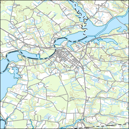
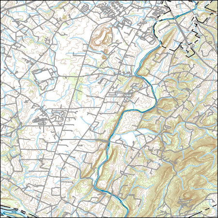
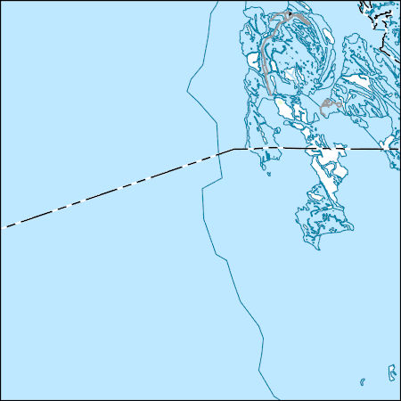
Layers of geospatial data include contours, boundaries, land cover, hydrography, roads, transportation, geographic names, structures, and other selected map features.
Tags: 7.5 x 7.5 minute,
7_5_Min,
Accomack,
Combined Vector,
Combined Vector, All tags...
Combined Vector,
Downloadable Data,
GeoPackage,
MD,
Maryland,
Open Geospatial Consortium GeoPackage 1.2,
Public Land Survey System,
Somerset,
Topo Map Vector Data,
US,
United States,
VA,
Virginia,
Worcester,
boundary,
contours,
geographic names,
hydrography,
structures,
transportation,
woodland, Fewer tags

Layers of geospatial data include contours, boundaries, land cover, hydrography, roads, transportation, geographic names, structures, and other selected map features.
Tags: 7.5 x 7.5 minute,
7_5_Min,
Combined Vector,
Combined Vector,
Combined Vector, All tags...
Downloadable Data,
Frederick,
GeoPackage,
Hampshire,
Morgan,
Open Geospatial Consortium GeoPackage 1.2,
Public Land Survey System,
Topo Map Vector Data,
US,
United States,
VA,
Virginia,
WV,
West Virginia,
boundary,
contours,
geographic names,
hydrography,
structures,
transportation,
woodland, Fewer tags

Layers of geospatial data include contours, boundaries, land cover, hydrography, roads, transportation, geographic names, structures, and other selected map features.
Tags: 7.5 x 7.5 minute,
7_5_Min,
Buchanan,
Combined Vector,
Combined Vector, All tags...
Combined Vector,
Downloadable Data,
GeoPackage,
KY,
Kentucky,
McDowell,
Mingo,
Open Geospatial Consortium GeoPackage 1.2,
Pike,
Public Land Survey System,
Topo Map Vector Data,
US,
United States,
VA,
Virginia,
WV,
West Virginia,
boundary,
contours,
geographic names,
hydrography,
structures,
transportation,
woodland, Fewer tags
Layers of geospatial data include contours, boundaries, land cover, hydrography, roads, transportation, geographic names, structures, and other selected map features.
Tags: 7.5 x 7.5 minute,
7_5_Min,
Buchanan,
Combined Vector,
Combined Vector, All tags...
Combined Vector,
Downloadable Data,
Esri Shapefile nan,
KY,
Kentucky,
McDowell,
Mingo,
Pike,
Public Land Survey System,
Shapefile,
Topo Map Vector Data,
US,
United States,
VA,
Virginia,
WV,
West Virginia,
boundary,
contours,
geographic names,
hydrography,
structures,
transportation,
woodland, Fewer tags
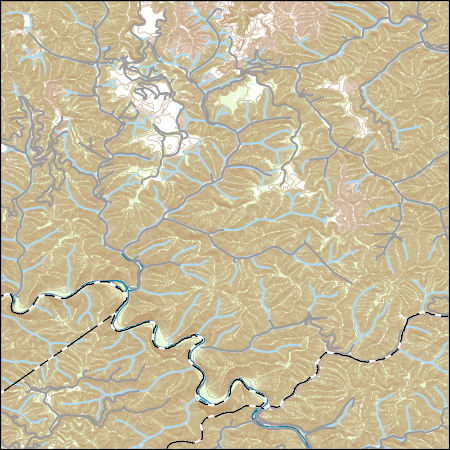
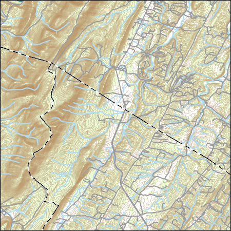
Layers of geospatial data include contours, boundaries, land cover, hydrography, roads, transportation, geographic names, structures, and other selected map features.
Types: Citation;
Tags: 7.5 x 7.5 minute,
7_5_Min,
Accomack,
Combined Vector,
Combined Vector, All tags...
Combined Vector,
Downloadable Data,
Esri Shapefile nan,
MD,
Maryland,
Public Land Survey System,
Shapefile,
Topo Map Vector Data,
US,
United States,
VA,
Virginia,
Worcester,
boundary,
contours,
geographic names,
hydrography,
structures,
transportation,
woodland, Fewer tags
Layers of geospatial data include contours, boundaries, land cover, hydrography, roads, transportation, geographic names, structures, and other selected map features.
Types: Citation;
Tags: 7.5 x 7.5 minute,
7_5_Min,
Combined Vector,
Combined Vector,
Combined Vector, All tags...
Downloadable Data,
Esri Shapefile nan,
Frederick,
Loudoun,
MD,
Maryland,
Montgomery,
Public Land Survey System,
Shapefile,
Topo Map Vector Data,
US,
United States,
VA,
Virginia,
boundary,
contours,
geographic names,
hydrography,
structures,
transportation,
woodland, Fewer tags
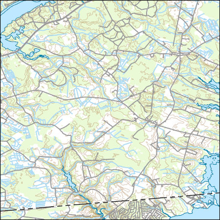
Layers of geospatial data include contours, boundaries, land cover, hydrography, roads, transportation, geographic names, structures, and other selected map features.
Types: Citation;
Tags: 7.5 x 7.5 minute,
7_5_Min,
Accomack,
Combined Vector,
Combined Vector, All tags...
Combined Vector,
Downloadable Data,
Esri Shapefile nan,
MD,
Maryland,
Public Land Survey System,
Shapefile,
Topo Map Vector Data,
US,
United States,
VA,
Virginia,
Worcester,
boundary,
contours,
geographic names,
hydrography,
structures,
transportation,
woodland, Fewer tags
Layers of geospatial data include contours, boundaries, land cover, hydrography, roads, transportation, geographic names, structures, and other selected map features.
Tags: 7.5 x 7.5 minute,
7_5_Min,
Accomack,
Combined Vector,
Combined Vector, All tags...
Combined Vector,
Downloadable Data,
GeoPackage,
MD,
Maryland,
Open Geospatial Consortium GeoPackage 1.2,
Public Land Survey System,
Somerset,
Topo Map Vector Data,
US,
United States,
VA,
Virginia,
boundary,
contours,
geographic names,
hydrography,
structures,
transportation,
woodland, Fewer tags
Layers of geospatial data include contours, boundaries, land cover, hydrography, roads, transportation, geographic names, structures, and other selected map features.
Types: Citation;
Tags: 7.5 x 7.5 minute,
7_5_Min,
Combined Vector,
Combined Vector,
Combined Vector, All tags...
Downloadable Data,
Esri File GeoDatabase 10,
FileGDB,
Frederick,
Hampshire,
Morgan,
Public Land Survey System,
Topo Map Vector Data,
US,
United States,
VA,
Virginia,
WV,
West Virginia,
boundary,
contours,
geographic names,
hydrography,
structures,
transportation,
woodland, Fewer tags
Layers of geospatial data include contours, boundaries, land cover, hydrography, roads, transportation, geographic names, structures, and other selected map features.
Types: Citation;
Tags: 7.5 x 7.5 minute,
7_5_Min,
Combined Vector,
Combined Vector,
Combined Vector, All tags...
Downloadable Data,
Esri File GeoDatabase 10,
FileGDB,
McDowell,
Public Land Survey System,
Tazewell,
Topo Map Vector Data,
US,
United States,
VA,
Virginia,
WV,
West Virginia,
boundary,
contours,
geographic names,
hydrography,
structures,
transportation,
woodland, Fewer tags
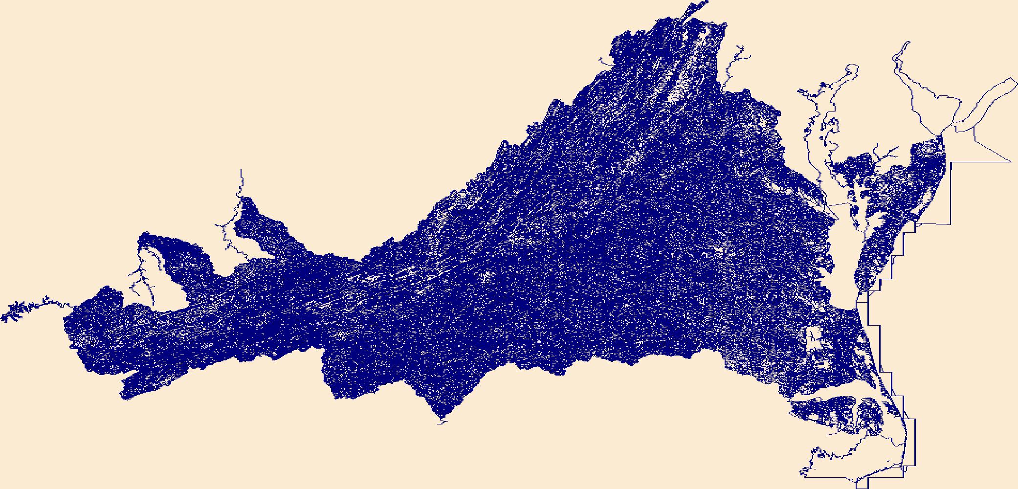
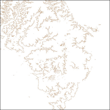
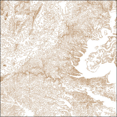
The National Hydrography Dataset (NHD) is a feature-based database that interconnects and uniquely identifies the stream segments or reaches that make up the nation's surface water drainage system. NHD data was originally developed at 1:100,000-scale and exists at that scale for the whole country. This high-resolution NHD, generally developed at 1:24,000/1:12,000 scale, adds detail to the original 1:100,000-scale NHD. (Data for Alaska, Puerto Rico and the Virgin Islands was developed at high-resolution, not 1:100,000 scale.) Local resolution NHD is being developed where partners and data exist. The NHD contains reach codes for networked features, flow direction, names, and centerline representations for areal water...
Tags: Accomack,
Administrative watershed units,
Administrative watershed units,
Albemarle,
Alexandria, All tags...
Alleghany,
Amelia,
Amherst,
Appomattox,
Area of Complex Channels,
Area to be submerged,
Arlington,
Augusta,
Basin,
Basin,
Bath,
Bay/Inlet,
Bedford,
Bland,
Botetourt,
Boundaries,
Boundary,
Bridge,
Bristol,
Brunswick,
Buchanan,
Buckingham,
Buena Vista,
Campbell,
Canal/Ditch,
Caroline,
Carroll,
Charles City,
Charlotte,
Charlottesville,
Chesapeake,
Chesterfield,
Clarke,
Coastline,
Colonial Heights,
Connector,
Covington,
Craig,
Culpeper,
Cumberland,
Dam/Weir,
Danville,
Dickenson,
Dinwiddie,
Downloadable Data,
Drainage areas for surface water,
Drainageway,
Emporia,
Esri Shapefile nan,
Essex,
Estuary,
Fairfax,
Falls Church,
Fauquier,
Flow direction network,
Floyd,
Flume,
Fluvanna,
ForeShore,
Franklin,
Frederick,
Fredericksburg,
Gaging Station,
Galax,
Gate,
Giles,
Gloucester,
Goochland,
Grayson,
Greene,
Greensville,
HU10,
HU12,
HU14,
HU16,
HU2,
HU4,
HU6,
HU8,
HUC,
Halifax,
Hampton,
Hanover,
Harrisonburg,
Hazard Zone,
Henrico,
Henry,
Highland,
Hopewell,
Hydrographic,
Hydrography,
Hydrography,
Hydrography,
Hydrologic Unit Code,
Hydrologic Units,
Ice mass,
Inundation Area,
Isle of Wight,
James City,
King George,
King William,
King and Queen,
Lancaster,
Lee,
Levee,
Lexington,
Line,
Lock Chamber,
Loudoun,
Louisa,
Lunenburg,
Lynchburg,
Madison,
Manassas,
Manassas Park,
Marsh,
Martinsville,
Mathews,
Mecklenburg,
Middlesex,
Montgomery,
National Hydrography Dataset (NHD),
National Hydrography Dataset (NHD) Best Resolution,
National Hydrography Dataset (NHD) Best Resolution,
Nelson,
New Kent,
Newport News,
Nonearthen Shore,
Norfolk,
Northampton,
Northumberland,
Norton,
Nottoway,
Orange,
Orthoimage,
Page,
Patrick,
Petersburg,
Pittsylvania,
Playa,
Point,
PointEvent,
Pond,
Poquoson,
Portsmouth,
Powhatan,
Prince Edward,
Prince George,
Prince William,
Pulaski,
Radford,
Rapids,
Rapids,
Rappahannock,
Reach,
Reach code,
Reef,
Region,
Reservoir,
Richmond,
Roanoke,
Rock,
Rockbridge,
Rockingham,
Russell,
Salem,
Scott,
Sea/Ocean,
Shapefile,
Shenandoah,
Sink/Rise,
Smyth,
Sounding Datum Line,
Southampton,
Special Use Zone,
Special Use Zone Limit,
Spillway,
Spotsylvania,
Stafford,
State,
State,
State_Virginia,
Staunton,
Stream,
Stream/River,
Sub-basin,
Sub-region,
Subbasin,
Submerged Stream,
Subregion,
Subwatershed,
Suffolk,
Surface water systems,
Surry,
Sussex,
Swamp,
Tazewell,
Topographic,
Tunnel,
US,
Underground Conduit,
United States,
VA,
Virginia,
Virginia Beach,
WBD,
WBD,
Wall,
Warren,
Wash,
Washington,
Water Intake Outflow,
Waterfall,
Watershed,
Watershed Boundaries,
Watershed Boundary Dataset,
Watershed Boundary Dataset,
Waynesboro,
Well,
Westmoreland,
Williamsburg,
Winchester,
Wise,
Wythe,
York,
artificial path,
boundaries,
dams,
drainage systems and characteristics,
inlandWaters,
lakes,
ngda,
rivers, Fewer tags
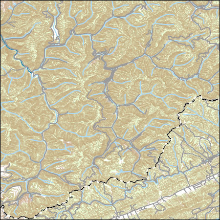
These vector contour lines are derived from the 3D Elevation Program using automated and semi-automated processes. They were created to support 1:24,000-scale CONUS and Hawaii, 1:25,000-scale Alaska, and 1:20,000-scale Puerto Rico / US Virgin Island topographic map products, but are also published in this GIS vector format. Contour intervals are assigned by 7.5-minute quadrangle, so this vector dataset is not visually seamless across quadrangle boundaries. The vector lines have elevation attributes (in feet above mean sea level on NAVD88), but this dataset does not carry line symbols or annotation.
Tags: 1 x 1 degree,
1X1,
Accomack,
Cape May,
Caroline, All tags...
DE,
Delaware,
Dorchester,
Downloadable Data,
Elevation,
Elevation Terrestrial,
Esri File GeoDatabase 10,
FileGDB,
Kent,
MD,
Maryland,
NJ,
National Elevation Dataset (NED),
National Elevation Dataset (NED) 1/3 arc-second - Contours,
National Elevation Dataset (NED) 1/3 arc-second - Contours,
New Jersey,
Queen Anne's,
Somerset,
Sussex,
Talbot,
US,
United States,
VA,
Virginia,
Wicomico,
Worcester,
elevation,
ngda, Fewer tags
These vector contour lines are derived from the 3D Elevation Program using automated and semi-automated processes. They were created to support 1:24,000-scale CONUS and Hawaii, 1:25,000-scale Alaska, and 1:20,000-scale Puerto Rico / US Virgin Island topographic map products, but are also published in this GIS vector format. Contour intervals are assigned by 7.5-minute quadrangle, so this vector dataset is not visually seamless across quadrangle boundaries. The vector lines have elevation attributes (in feet above mean sea level on NAVD88), but this dataset does not carry line symbols or annotation.
Tags: 1 x 1 degree,
1X1,
Alexandria,
Arlington,
Caroline, All tags...
Charles,
Clarke,
Culpeper,
DC,
District of Columbia,
District of Columbia,
Downloadable Data,
Elevation,
Elevation Terrestrial,
Essex,
Fairfax,
Falls Church,
Fauquier,
Fredericksburg,
GeoPackage,
Hanover,
King George,
Loudoun,
Louisa,
MD,
Manassas,
Manassas Park,
Maryland,
Montgomery,
National Elevation Dataset (NED),
National Elevation Dataset (NED) 1/3 arc-second - Contours,
National Elevation Dataset (NED) 1/3 arc-second - Contours,
Open Geospatial Consortium GeoPackage 1.2,
Orange,
Prince George's,
Prince William,
Rappahannock,
Spotsylvania,
Stafford,
US,
United States,
VA,
Virginia,
Westmoreland,
elevation,
ngda, Fewer tags
|
|

