Filters: Tags: WEBER (X)
229 results (145ms)|
Filters
Date Range
Types Contacts
Categories Tag Types Tag Schemes |
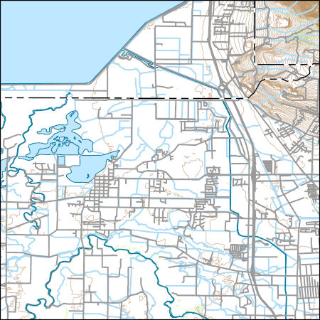
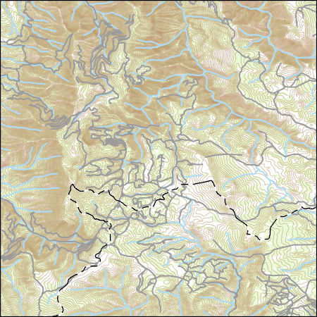
Layered geospatial PDF Map. Layers of geospatial data include orthoimagery, roads, grids, geographic names, elevation contours, hydrography, and other selected map features.
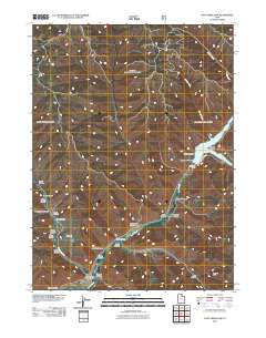
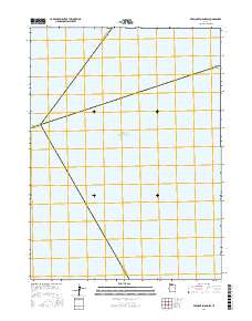
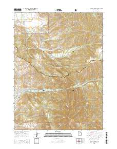
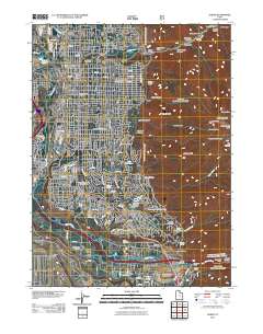
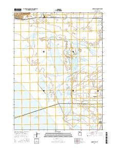
Layered GeoPDF 7.5 Minute Quadrangle Map. Layers of geospatial data include orthoimagery, roads, grids, geographic names, elevation contours, hydrography, and other selected map features.

Geospatial data includes structures and other selected map features.
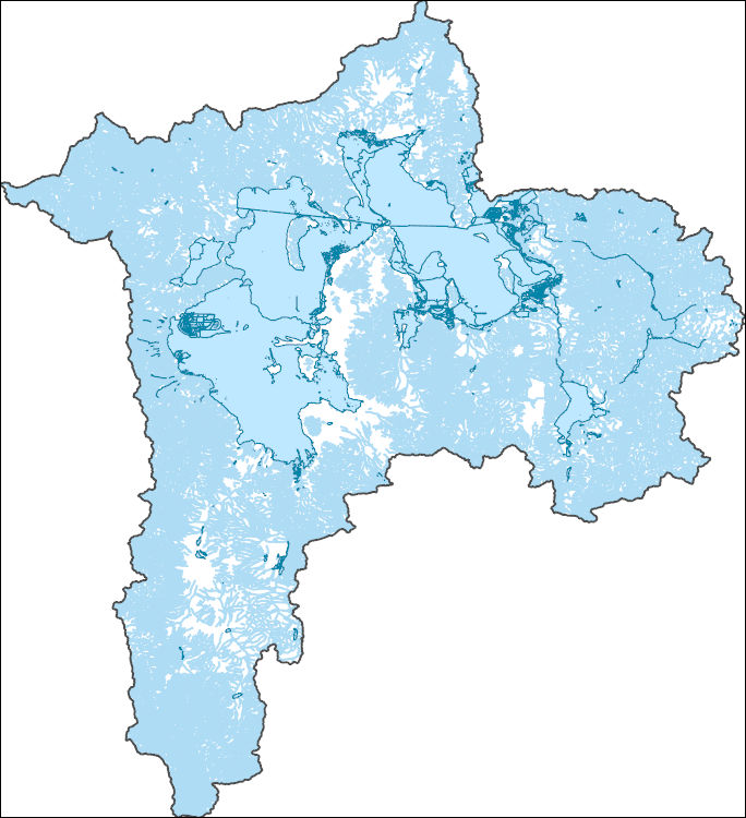
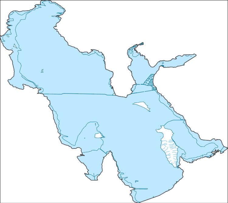
Geospatial data is comprised of government boundaries.
Layers of geospatial data include contours, boundaries, land cover, hydrography, roads, transportation, geographic names, structures, and other selected map features.
Layers of geospatial data include contours, boundaries, land cover, hydrography, roads, transportation, geographic names, structures, and other selected map features.

The National Hydrography Dataset (NHD) is a feature-based database that interconnects and uniquely identifies the stream segments or reaches that make up the nation's surface water drainage system. NHD data was originally developed at 1:100,000-scale and exists at that scale for the whole country. This high-resolution NHD, generally developed at 1:24,000/1:12,000 scale, adds detail to the original 1:100,000-scale NHD. (Data for Alaska, Puerto Rico and the Virgin Islands was developed at high-resolution, not 1:100,000 scale.) Local resolution NHD is being developed where partners and data exist. The NHD contains reach codes for networked features, flow direction, names, and centerline representations for areal water...
Core Research Center, core C885, from well operated by CHAMPLIN PETROLEUMRaw Properties from download, web scrape, MapServer, and Macrostrat API{"Lib Num": "C885", "API Num": "4903720499", "Operator": "CHAMPLIN PETROLEUM", "Well Name": "11 W BRADY DEEP UNIT", "Field": "BRADY", "State": "WY", "County": "SWEETWATER", "Type": "SLABBED", "Photos": "F", "Thin Sec": "T", "Analysis": "F", "Latitude": "41.40875", "Longitude": "-108.72672", "coordinates_geohash": "9x6etf5x7y3r", "Source": "FROM STATE RECORDS", "Security Flag": "NO SPECIAL RESTRICTIONS", "crc_collection_name": "core", "sb_parent_id": "4f4e49dae4b07f02db5e0486", "intervals": [{"Formation": "WEBER", "Age": "PENN", "Min Depth": "14003", "Max Depth": "14103"},...
Core Research Center, core R715, from well operated by QEP RESOURCESRaw Properties from download, web scrape, MapServer, and Macrostrat API{"Lib Num": "R715", "API Num": "4300915635", "Operator": "QEP RESOURCES", "Well Name": "MURPHY 6-W", "Field": "CLAY BASIN", "State": "UT", "County": "DAGGETT", "Type": "THICK SLAB", "Photos": "F", "Thin Sec": "F", "Analysis": "F", "Latitude": "40.9855782", "Longitude": "-109.1962696", "coordinates_geohash": "9x635jjwq3xc", "Source": null, "Security Flag": null, "crc_collection_name": "core", "sb_parent_id": "4f4e49dae4b07f02db5e0486", "intervals": [{"Formation": "WEBER", "Age": "PENNSYLVANIAN", "Min Depth": "9040", "Max Depth": "9062"}, {"Formation": "WEBER", "Age": "PENNSYLVANIAN",...
Categories: Physical Item;
Tags: Baxter Shale,
Baxter Shale,
PENNSYLVANIAN,
PENNSYLVANIAN,
PENNSYLVANIAN,
The National Hydrography Dataset (NHD) is a feature-based database that interconnects and uniquely identifies the stream segments or reaches that make up the nation's surface water drainage system. NHD data was originally developed at 1:100,000-scale and exists at that scale for the whole country. This high-resolution NHD, generally developed at 1:24,000/1:12,000 scale, adds detail to the original 1:100,000-scale NHD. (Data for Alaska, Puerto Rico and the Virgin Islands was developed at high-resolution, not 1:100,000 scale.) Local resolution NHD is being developed where partners and data exist. The NHD contains reach codes for networked features, flow direction, names, and centerline representations for areal water...
Layered GeoPDF 7.5 Minute Quadrangle Map. Layers of geospatial data include orthoimagery, roads, grids, geographic names, elevation contours, hydrography, and other selected map features.
Layered GeoPDF 7.5 Minute Quadrangle Map. Layers of geospatial data include orthoimagery, roads, grids, geographic names, elevation contours, hydrography, and other selected map features.
Layered geospatial PDF Map. Layers of geospatial data include orthoimagery, roads, grids, geographic names, elevation contours, hydrography, and other selected map features.
Core Research Center, core A741, from well operated by CHAMPLIN PETROLEUMRaw Properties from download, web scrape, MapServer, and Macrostrat API{"Lib Num": "A741", "API Num": "4903720618", "Operator": "CHAMPLIN PETROLEUM", "Well Name": "18 W BRADY DEEP UNIT", "Field": "BRADY", "State": "WY", "County": "SWEETWATER", "Type": "SLABBED", "Photos": "T", "Thin Sec": "T", "Analysis": "T", "Latitude": "41.37448", "Longitude": "-108.74048", "coordinates_geohash": "9x6emecxg4j6", "Source": "FROM STATE RECORDS", "Security Flag": "NO SPECIAL RESTRICTIONS", "crc_collection_name": "core", "sb_parent_id": "4f4e49dae4b07f02db5e0486", "intervals": [{"Formation": "WEBER", "Age": "PENN", "Min Depth": "14282", "Max Depth": "14485"}],...
Categories: Physical Item;
Tags: Eocene,
Main body, Wasatch Formation,
PENN,
WEBER,
Wasatch Formation
Core Research Center, core B106, from well operated by SUPERIOR OIL COMPANYRaw Properties from download, web scrape, MapServer, and Macrostrat API{"Lib Num": "B106", "API Num": "0508106303", "Operator": "SUPERIOR OIL COMPANY", "Well Name": "1 STATE", "Field": "FOUR MILE CREEK", "State": "CO", "County": "MOFFAT", "Type": "SLABBED", "Photos": "T", "Thin Sec": "T", "Analysis": "T", "Latitude": "40.934683", "Longitude": "-107.594385", "coordinates_geohash": "9x72zeujv1gx", "Source": "FROM STATE RECORDS", "Security Flag": "NO SPECIAL RESTRICTIONS", "crc_collection_name": "core", "sb_parent_id": "4f4e49dae4b07f02db5e0486", "intervals": [{"Formation": "WEBER", "Age": "PENN", "Min Depth": "15578", "Max Depth": "15596"}],...
Core Research Center, core C878, from well operated by CHAMPLIN PETROLEUMRaw Properties from download, web scrape, MapServer, and Macrostrat API{"Lib Num": "C878", "API Num": null, "Operator": "CHAMPLIN PETROLEUM", "Well Name": "41-2 BRADY", "Field": "BRADY", "State": "WY", "County": "SWEETWATER", "Type": "SLABBED", "Photos": "T", "Thin Sec": "T", "Analysis": "F", "Latitude": "41.39433", "Longitude": "-108.74774", "coordinates_geohash": "9x6emrs73yru", "Source": "CENTER OF SECTION", "Security Flag": "NO SPECIAL RESTRICTIONS", "crc_collection_name": "core", "sb_parent_id": "4f4e49dae4b07f02db5e0486", "intervals": [{"Formation": "WEBER", "Age": "PENN", "Min Depth": "13831", "Max Depth": "14318"}], "crcwc_url": "https://my.usgs.gov/crcwc/core/report/10934",...
Categories: Physical Item;
Tags: Eocene,
Main body, Wasatch Formation,
PENN,
WEBER,
Wasatch Formation
The National Hydrography Dataset (NHD) is a feature-based database that interconnects and uniquely identifies the stream segments or reaches that make up the nation's surface water drainage system. NHD data was originally developed at 1:100,000-scale and exists at that scale for the whole country. This high-resolution NHD, generally developed at 1:24,000/1:12,000 scale, adds detail to the original 1:100,000-scale NHD. (Data for Alaska, Puerto Rico and the Virgin Islands was developed at high-resolution, not 1:100,000 scale.) Local resolution NHD is being developed where partners and data exist. The NHD contains reach codes for networked features, flow direction, names, and centerline representations for areal water...
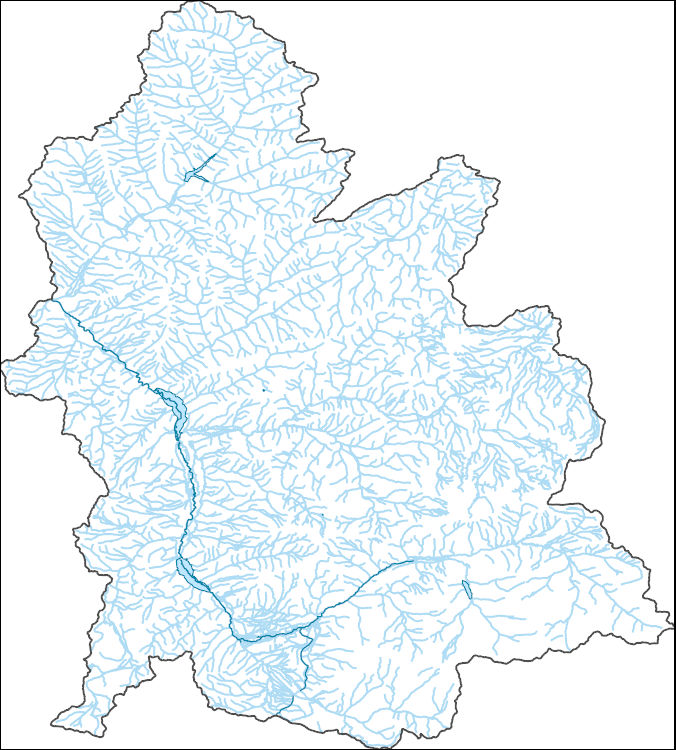
The National Hydrography Dataset (NHD) is a feature-based database that interconnects and uniquely identifies the stream segments or reaches that make up the nation's surface water drainage system. NHD data was originally developed at 1:100,000-scale and exists at that scale for the whole country. This high-resolution NHD, generally developed at 1:24,000/1:12,000 scale, adds detail to the original 1:100,000-scale NHD. (Data for Alaska, Puerto Rico and the Virgin Islands was developed at high-resolution, not 1:100,000 scale.) Local resolution NHD is being developed where partners and data exist. The NHD contains reach codes for networked features, flow direction, names, and centerline representations for areal water...
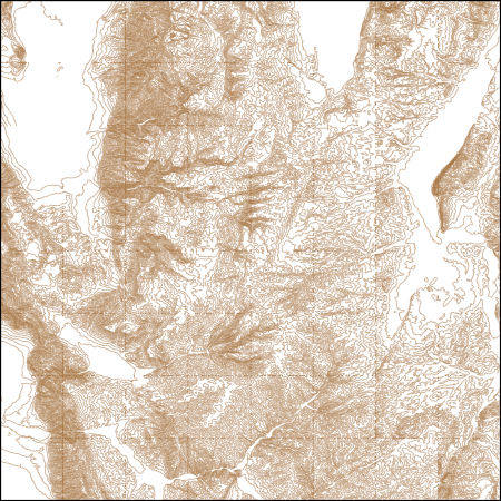
These vector contour lines are derived from the 3D Elevation Program using automated and semi-automated processes. They were created to support 1:24,000-scale CONUS and Hawaii, 1:25,000-scale Alaska, and 1:20,000-scale Puerto Rico / US Virgin Island topographic map products, but are also published in this GIS vector format. Contour intervals are assigned by 7.5-minute quadrangle, so this vector dataset is not visually seamless across quadrangle boundaries. The vector lines have elevation attributes (in feet above mean sea level on NAVD88), but this dataset does not carry line symbols or annotation.
Geospatial data includes structures and other selected map features.
|

|
