Filters: Tags: Wind River (X)
24 results (121ms)|
Filters
Date Range
Extensions Types
Contacts
Categories Tag Types
|
Collaboration on the Wind River: Eastern Shoshone, Northern Arapaho team up with scientist coalition
The Eastern Shoshone and Northern Arapaho Tribes on the Wind River Indian Reservation in Wyoming are preparing for drought and other climate fluctuations with help from a broad coalition of scientists. Read More: https://www.drought.gov/drought/sites/drought.gov.drought/files/media/whatisnidis/Newsletter/October%202015%20v4.pdf
In 2020, the U.S. Geological Survey (USGS) assessed the potential for undiscovered, technically recoverable continuous (unconventional) oil and gas resources in the Mowry Shale in the Wind River Basin Province (Finn and others, 2021). To better characterize the source rock potential of the Mowry Shale and associated strata, 129 samples were collected from 45 wells from the well cuttings collection stored at the USGS Core Research Center in Lakewood, Colorado. The sampled wells are located along the margins of the basin in order to obtain samples that were not subjected to the effects of deep burial and subsequent organic carbon loss due to thermal maturation (Daly and Edman, 1987) (fig. 1). One hundred samples are...
Categories: Data;
Tags: Energy Resources,
Mowry Shale,
Thermopolis Shale,
USGS Science Data Catalog (SDC),
Wind River,
Wind River Reservation Tribes work with research coalition to enhance drought and climate resilience
The Eastern Shoshone and Northern Arapaho Tribes on the Wind River Indian Reservation in Wyoming are preparing for drought and other climate fluctuations with help from a broad coalition of scientists, including groups at the University of Nebraska-Lincoln. Read More: http://drought.unl.edu/NewsOutreach/NDMCNews.aspx?id=204
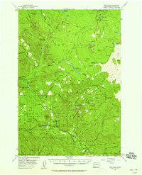
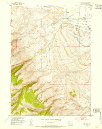
USGS Historical Quadrangle in GeoPDF.
The Wind River Indian Reservation is an area encompassing approximately 9,000 square kilometers in northwest Wyoming shared by the Eastern Shoshone and Northern Arapaho tribes of the Native American Indian Nations. The boundary feature was generated by the U.S. Geological Survey to represent the external boundary of the reservation at a scale of 1:500,000.
Categories: Data;
Types: Downloadable,
Map Service,
OGC WFS Layer,
OGC WMS Layer,
Shapefile;
Tags: Arapaho,
Indian,
Reservation,
Shoshone,
Wind River,
Coalbed methane is one of the most important and valuable natural resources in the Western United States. The natural gas that results from CBM development is the cleanest burning fossil fuel, and the extensive domestic supply makes it a central element of the national goal of a secure supply of energy. Demand for natural gas will continue to grow and CBM will play an increasingly larger role in meeting that demand. CBM production has expanded tremendously over the past decade, and the rapidity with which development has expanded has resulted in stresses and tension in affected communities. Development of this important energy resource must be balanced with a number of other important goals of protecting water,...
Categories: Publication;
Types: Citation;
Tags: Coal-bed,
Indian Reservation,
Wind River,
methane,
potential
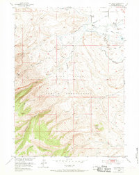
USGS Historical Quadrangle in GeoPDF.
Core Research Center, core D413, from well operated by AMOCO PRODUCTIONRaw Properties from download, web scrape, MapServer, and Macrostrat API{"Lib Num": "D413", "API Num": "4901308277", "Operator": "AMOCO PRODUCTION", "Well Name": "1-14 SHOSHONE ARAPAHOE TRIBAL", "Field": "WILDCAT", "State": "WY", "County": "FREMONT", "Type": "SLABBED", "Photos": "T", "Thin Sec": "T", "Analysis": "T", "Latitude": "43.15539", "Longitude": "-108.49149", "coordinates_geohash": "9xdve0nym5c8", "Source": "FROM STATE RECORDS", "Security Flag": "NO SPECIAL RESTRICTIONS", "crc_collection_name": "core", "sb_parent_id": "4f4e49dae4b07f02db5e0486", "intervals": [{"Formation": "WIND RIVER", "Age": "TERT", "Min Depth": "3741", "Max Depth":...
Coalbed methane is one of the most important and valuable natural resources in the Western United States. The natural gas that results from CBM development is the cleanest burning fossil fuel, and the extensive domestic supply makes it a central element of the national goal of a secure supply of energy. Demand for natural gas will continue to grow and CBM will play an increasingly larger role in meeting that demand. CBM production has expanded tremendously over the past decade, and the rapidity with which development has expanded has resulted in stresses and tension in affected communities. Development of this important energy resource must be balanced with a number of other important goals of protecting water,...
Categories: Publication;
Types: Citation;
Tags: Coal-bed,
Indian Reservation,
Wind River,
methane,
potential
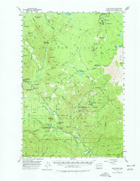
USGS Historical Quadrangle in GeoPDF.
View of massive weathered rock exposure, head of Wigins Creek, head of the Wind River. Fremont County, Wyoming. ca. 1903.
Categories: Image;
Tags: Fremont County, Wyoming,
Photographers,
Walcott, C.D. Collection,
Wind River,
photo print
Coalbed methane is one of the most important and valuable natural resources in the Western United States. The natural gas that results from CBM development is the cleanest burning fossil fuel, and the extensive domestic supply makes it a central element of the national goal of a secure supply of energy. Demand for natural gas will continue to grow and CBM will play an increasingly larger role in meeting that demand. CBM production has expanded tremendously over the past decade, and the rapidity with which development has expanded has resulted in stresses and tension in affected communities. Development of this important energy resource must be balanced with a number of other important goals of protecting water,...
Categories: Publication;
Types: Citation;
Tags: Coal-bed,
Indian Reservation,
Wind River,
methane,
potential
Core Research Center, core D381, from well operated by HUSKY OILRaw Properties from download, web scrape, MapServer, and Macrostrat API{"Lib Num": "D381", "API Num": "4901321112", "Operator": "HUSKY OIL", "Well Name": "11-16 TRIBAL", "Field": "MUDDY RIDGE", "State": "WY", "County": "FREMONT", "Type": "SLABBED", "Photos": "F", "Thin Sec": "T", "Analysis": "F", "Latitude": "43.32229", "Longitude": "-108.53199", "coordinates_geohash": "9xdy6q96tk4w", "Source": "FROM STATE RECORDS", "Security Flag": "NO SPECIAL RESTRICTIONS", "crc_collection_name": "core", "sb_parent_id": "4f4e49dae4b07f02db5e0486", "intervals": [{"Formation": "WIND RIVER", "Age": "TERT", "Min Depth": "3464", "Max Depth": "3519"}], "crcwc_url": "https://my.usgs.gov/crcwc/core/report/11121",...
Categories: Physical Item;
Tags: Alluvium and Colluvium,
Pleistocene - Holocene,
TERT,
WIND RIVER,
clay,
Some of the mule deer (Odocoileus hemionus) in the southwestern section of the Wind River Indian Reservation are unique, because their entire migration routes are within Eastern Shoshone and Northern Arapaho lands (fig. 29). In the spring, deer migrate from the foothills of the Wind River Range upslope to the Tribes’ Wind River Roadless Area, or northwest into the Shoshone and Bridger-Teton National Forests or Grand Teton National Park, demonstrating how the reservation is part of the Greater Yellowstone Ecosystem. The herd, which numbers around 1500, winters entirely within the Reservation, from the western boundary of the Reservation to south of Fort Washakie. Winter habitats consist of upland shrubs, sage, grasses...
Categories: Data;
Types: Downloadable,
Map Service,
OGC WFS Layer,
OGC WMS Layer,
Shapefile;
Tags: United States,
Wind River,
Wyoming,
animal behavior,
migration (organisms),
The Wind River Indian Reservation in west-central Wyoming is home to the Eastern Shoshone and Northern Arapaho tribes, who reside near and depend on water from the streams that feed into the Wind River. In recent years, however, the region has experienced frequent severe droughts, which have impacted tribal livelihoods and cultural activities. Scientists with the North Central Climate Science Center at Colorado State University, the National Drought Mitigation Center at the University of Nebraska-Lincoln, and several other university and agency partners are working closely with tribal water managers to assess how drought affects the reservation, integrating social, ecological, and hydro-climatological sciences...
Categories: Project;
Types: Map Service,
OGC WFS Layer,
OGC WMS Layer,
OGC WMS Service;
Tags: 2015,
CASC,
Completed,
Data Visualization & Tools,
Drought,
Coalbed methane is one of the most important and valuable natural resources in the Western United States. The natural gas that results from CBM development is the cleanest burning fossil fuel, and the extensive domestic supply makes it a central element of the national goal of a secure supply of energy. Demand for natural gas will continue to grow and CBM will play an increasingly larger role in meeting that demand. CBM production has expanded tremendously over the past decade, and the rapidity with which development has expanded has resulted in stresses and tension in affected communities. Development of this important energy resource must be balanced with a number of other important goals of protecting water,...
Categories: Publication;
Types: Citation;
Tags: Coal-bed,
Indian Reservation,
Wind River,
methane,
potential
The HPRCC has an established partnership with the North Central Climate Science Center (NC CSC) and has enjoyed collaborating on regional projects since its inception. Housed at Colorado State University in Fort Collins, the NC CSC is one of eight such centers that were established in 2010 within the U.S. Department of the Interior. The mission of the Climate Science Centers is to help meet the changing needs of land and resource managers across the U.S. (For more information on the Climate Science Centers, please visit: https://www.doi.gov/csc/about.) The NC CSC collaborates with a consortium of nine institutions that provide expertise in climate science and sectors impacted by climate. The University of Nebraska-Lincoln,...
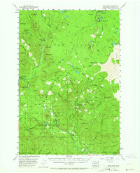
USGS Historical Quadrangle in GeoPDF.
USGS Historical Quadrangle in GeoPDF.
|

|
