Filters: Tags: Yolo (X)
116 results (56ms)|
Filters
Date Range
Types Contacts
Categories Tag Types Tag Schemes |

Layers of geospatial data include roads, airports, trails, and railroads.
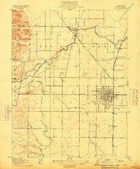
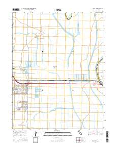
USGS Historical Quadrangle in GeoPDF.
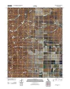
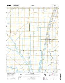
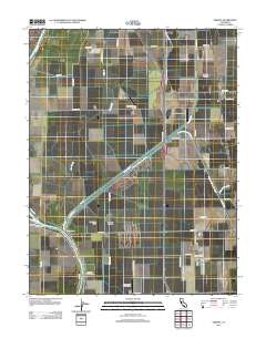
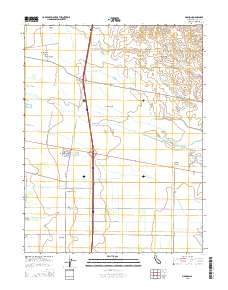
Layered GeoPDF 7.5 Minute Quadrangle Map. Layers of geospatial data include orthoimagery, roads, grids, geographic names, elevation contours, hydrography, and other selected map features.
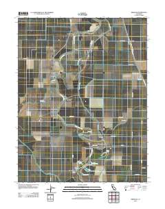
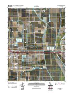
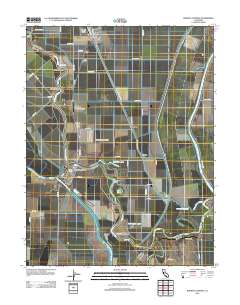
Layered GeoPDF 7.5 Minute Quadrangle Map. Layers of geospatial data include orthoimagery, roads, grids, geographic names, elevation contours, hydrography, and other selected map features.
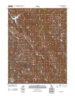
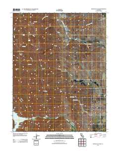
Layered GeoPDF 7.5 Minute Quadrangle Map. Layers of geospatial data include orthoimagery, roads, grids, geographic names, elevation contours, hydrography, and other selected map features.
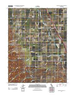
Layered GeoPDF 7.5 Minute Quadrangle Map. Layers of geospatial data include orthoimagery, roads, grids, geographic names, elevation contours, hydrography, and other selected map features.
Layered GeoPDF 7.5 Minute Quadrangle Map. Layers of geospatial data include orthoimagery, roads, grids, geographic names, elevation contours, hydrography, and other selected map features.
Layered GeoPDF 7.5 Minute Quadrangle Map. Layers of geospatial data include orthoimagery, roads, grids, geographic names, elevation contours, hydrography, and other selected map features.
Layered GeoPDF 7.5 Minute Quadrangle Map. Layers of geospatial data include orthoimagery, roads, grids, geographic names, elevation contours, hydrography, and other selected map features.
Layered GeoPDF 7.5 Minute Quadrangle Map. Layers of geospatial data include orthoimagery, roads, grids, geographic names, elevation contours, hydrography, and other selected map features.
Geospatial data includes structures and other selected map features.
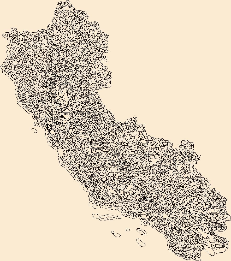
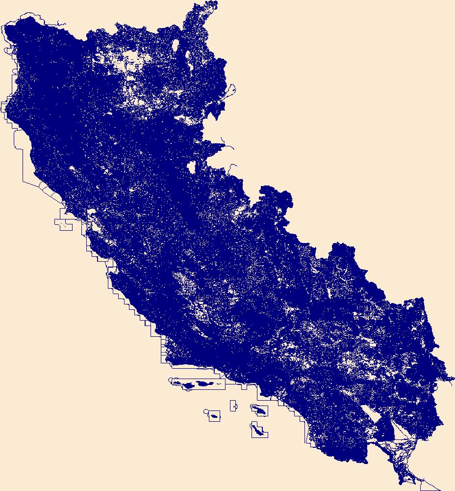
The Watershed Boundary Dataset (WBD) is a comprehensive aggregated collection of hydrologic unit data consistent with the national criteria for delineation and resolution. It defines the areal extent of surface water drainage to a point except in coastal or lake front areas where there could be multiple outlets as stated by the "Federal Standards and Procedures for the National Watershed Boundary Dataset (WBD)" "Standard" (https://pubs.usgs.gov/tm/11/a3/). Watershed boundaries are determined solely upon science-based hydrologic principles, not favoring any administrative boundaries or special projects, nor particular program or agency. This dataset represents the hydrologic unit boundaries to the 12-digit (6th level)...
The goal of this study was to develop a suite of inter-related water quality monitoring approaches capable of modeling and estimating the spatial and temporal gradients of particulate and dissolved total mercury (THg) concentration and particulate and dissolved methyl mercury (MeHg) concentration in surface waters across the Sacramento / San Joaquin River Delta (SSJRD). This suite of monitoring approaches included: a) data collection at fixed continuous monitoring stations (CMS) outfitted with in-situ sensors, b) spatial mapping using boat-mounted, flow-through, sensors and c) satellite-based remote sensing. The focus of this specific Child Page is to present all data collected during the underway boat mapping component...
Categories: Data;
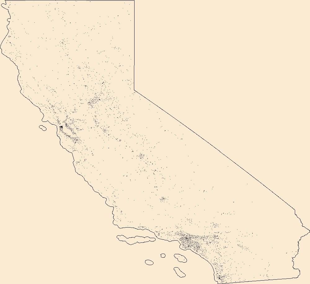
Tags: California,
Lower Sacramento,
Sacramento,
San Francisco Bay,
San Joaquin Delta,
The Sacramento / San Joaquin River Delta (SSJRD) is contaminated with legacy mercury (Hg) from historical mining and mineral processing activities throughout the watershed, as well as from contemporary atmospheric and industrial inputs. The current project was designed for the purpose of developing high-resolution spatial and temporal models for estimating concentrations of mercury species in surface waters of the SSJRD. The field component of the project brings together three high-resolution platforms for collecting water-quality data (fixed continuous monitoring stations (CMS) outfitted with in-situ sensors, spatial mapping using boat-mounted flow-through sensors, and satellite-based remote sensing) coupled with...
Categories: Data;
Tags: California,
Environmental Health,
Geochemistry,
Lower Sacramento,
Remote Sensing,
Layered GeoPDF 7.5 Minute Quadrangle Map. Layers of geospatial data include orthoimagery, roads, grids, geographic names, elevation contours, hydrography, and other selected map features.
Layered GeoPDF 7.5 Minute Quadrangle Map. Layers of geospatial data include orthoimagery, roads, grids, geographic names, elevation contours, hydrography, and other selected map features.
Layered GeoPDF 7.5 Minute Quadrangle Map. Layers of geospatial data include orthoimagery, roads, grids, geographic names, elevation contours, hydrography, and other selected map features.
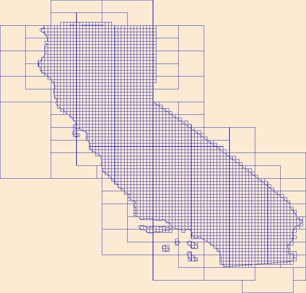
This data represents the map extent for current and historical USGS topographic maps for the United States and Territories, including 1 X 2 Degree, 1 X 1 Degree, 30 X 60 Minute, 15 X 15 Minute, 7.5 X 7.5 Minute, and 3.75 X 3.75 Minute. The grid was generated using ESRI ArcInfo GIS software.
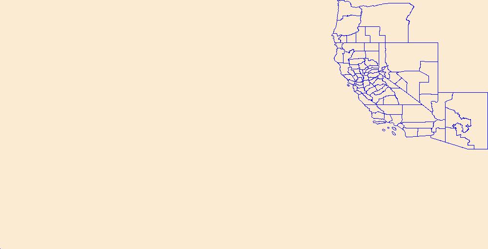
Geospatial data is comprised of government boundaries.
The National Hydrography Dataset (NHD) is a feature-based database that interconnects and uniquely identifies the stream segments or reaches that make up the nation's surface water drainage system. NHD data was originally developed at 1:100,000-scale and exists at that scale for the whole country. This high-resolution NHD, generally developed at 1:24,000/1:12,000 scale, adds detail to the original 1:100,000-scale NHD. (Data for Alaska, Puerto Rico and the Virgin Islands was developed at high-resolution, not 1:100,000 scale.) Local resolution NHD is being developed where partners and data exist. The NHD contains reach codes for networked features, flow direction, names, and centerline representations for areal water...
|

|
