Filters: Tags: petroleum (X)
431 results (58ms)|
Filters
Date Range
Extensions Types
Contacts
Categories
Tag Types Tag Schemes |
This dataset is based on U.S. Geological Survey (USGS) resource assessments for “undiscovered” natural gas liquid resources, which are resources that have not yet been extensively proven by drilling (USGS 2014). Individual resource assessments describe the amount of petroleum resources in units with similar geologic features. We quantified the density of natural gas liquid resources by adding together the amounts in spatially overlapping assessment units and dividing these totals by polygon areas. Since assessments for geologic areas used in this analysis were completed at various times, the certainty related to these values is likely to vary according to geologic unit. USGS [U.S. Geological Survey]. 2014. Energy...
Categories: Data;
Types: Downloadable,
GeoTIFF,
Map Service,
Raster;
Tags: Arizona,
Colorado,
Colorado headwaters-Plateau,
Nevada,
New Mexico,
The paper traces the manner in which an obligation came to be imposed on select industries, requiring them to take account of amenity, wildlife and outdoor-recreational interests in the course of preparing and carrying out developmental schemes. Under pressure from the relevant voluntary bodies, the statutory obligations, first imposed on hydro-electric power development, were generalized to cover 'whole' industries, and then, under the Countryside Acts of 1967-68, were extended to all State utilities. The recent privatization of those industries has provided a further pretext for extending and strengthening the 'amenity' clause. The approach has provided important insights into how industry itself might become...
Categories: Publication;
Types: Citation;
Tags: Alternative,
CO2 emissions,
Technology,
analysis,
approaches,
Woodland caribou (Rangifer tarandus caribou) in Alberta are classified as endangered and apparently have declined. Disturbance from petroleum exploration has been implicated as a possible cause, so we constructed a simple model to estimate the energy costs of multiple encounters with disturbance (i.e., loud noise). Our objective was to estimate if woodland caribou in northeastern Alberta have been exposed to enough disturbance from 1988 to 1993 to cause winter mass loss to exceed either (i) 15% autumn mass or (ii) 20% autumn mass. A single disturbance event costs caribou 3.46-5.81 MJ. Caribou would have to encounter (i) 20-34 (mean = 27) disturbance events to lose >15% mass over winter and (ii) 41-137 (mean = 89)...
Categories: Publication;
Types: Citation;
Tags: Energetic,
caribou,
disturbance,
exploration,
implications,
This data release contains the boundaries of assessment units and input data for the assessment of continuous oil and gas resources in the Delle Phosphatic Member of the Mississippian Woodman Formation, western Utah, eastern Nevada and southeastern Idaho. The Assessment Unit is the fundamental unit used in the National Assessment Project for the assessment of undiscovered oil and gas resources. The Assessment Unit is defined within the context of the higher-level Total Petroleum System. The Assessment Unit is shown herein as a geographic boundary interpreted, defined, and mapped by the geologist responsible for the province and incorporates a set of known or postulated oil and (or) gas accumulations sharing similar...
This data release contains the boundaries of assessment units and input data for the assessment of undiscovered gas hydrate resources on the north slope of Alaska. The Assessment Unit is the fundamental unit used in the National Assessment Project for the assessment of undiscovered oil and gas resources. The Assessment Unit is defined within the context of the higher-level Total Petroleum System. The Assessment Unit is shown herein as a geographic boundary interpreted, defined, and mapped by the geologist responsible for the province and incorporates a set of known or postulated oil and (or) gas accumulations sharing similar geologic, geographic, and temporal properties within the Total Petroleum System, such as...
Categories: Data;
Types: Downloadable,
Map Service,
OGC WFS Layer,
OGC WMS Layer,
Shapefile;
Tags: Assessment Unit,
Continuous Assessment Unit,
Earth Science,
Economic geology,
Energy Resources,
This data release contains the boundaries of assessment of undiscovered continuous tight-gas resources in the Mesaverde Group and Wasatch Formation, Uinta-Piceance Province, Utah and Colorado. The Assessment Unit is the fundamental unit used in the National Assessment Project for the assessment of undiscovered oil and gas resources. The Assessment Unit is defined within the context of the higher-level Total Petroleum System. The Assessment Unit is shown herein as a geographic boundary interpreted, defined, and mapped by the geologist responsible for the province and incorporates a set of known or postulated oil and (or) gas accumulations sharing similar geologic, geographic, and temporal properties within the Total...
Categories: Data;
Types: Downloadable,
Map Service,
OGC WFS Layer,
OGC WMS Layer,
Shapefile;
Tags: Assessment Unit,
Continuous Assessment Unit,
Earth Science,
Energy Resources,
Energy Resources,
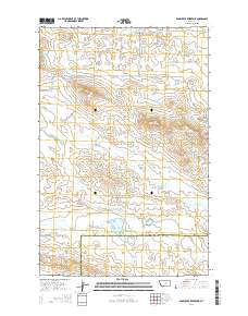
Layered GeoPDF 7.5 Minute Quadrangle Map. Layers of geospatial data include orthoimagery, roads, grids, geographic names, elevation contours, hydrography, and other selected map features.
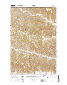
Layered GeoPDF 7.5 Minute Quadrangle Map. Layers of geospatial data include orthoimagery, roads, grids, geographic names, elevation contours, hydrography, and other selected map features.
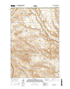
Layered geospatial PDF Map. Layers of geospatial data include orthoimagery, roads, grids, geographic names, elevation contours, hydrography, and other selected map features.
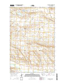
Layered GeoPDF 7.5 Minute Quadrangle Map. Layers of geospatial data include orthoimagery, roads, grids, geographic names, elevation contours, hydrography, and other selected map features.
Layered GeoPDF 7.5 Minute Quadrangle Map. Layers of geospatial data include orthoimagery, roads, grids, geographic names, elevation contours, hydrography, and other selected map features.
Layered GeoPDF 7.5 Minute Quadrangle Map. Layers of geospatial data include orthoimagery, roads, grids, geographic names, elevation contours, hydrography, and other selected map features.
Layered geospatial PDF Map. Layers of geospatial data include orthoimagery, roads, grids, geographic names, elevation contours, hydrography, and other selected map features.
Layered geospatial PDF Map. Layers of geospatial data include orthoimagery, roads, grids, geographic names, elevation contours, hydrography, and other selected map features.
Layered GeoPDF 7.5 Minute Quadrangle Map. Layers of geospatial data include orthoimagery, roads, grids, geographic names, elevation contours, hydrography, and other selected map features.
Layered GeoPDF 7.5 Minute Quadrangle Map. Layers of geospatial data include orthoimagery, roads, grids, geographic names, elevation contours, hydrography, and other selected map features.
Layered geospatial PDF Map. Layers of geospatial data include orthoimagery, roads, grids, geographic names, elevation contours, hydrography, and other selected map features.
Layered geospatial PDF Map. Layers of geospatial data include orthoimagery, roads, grids, geographic names, elevation contours, hydrography, and other selected map features.
Layered GeoPDF 7.5 Minute Quadrangle Map. Layers of geospatial data include orthoimagery, roads, grids, geographic names, elevation contours, hydrography, and other selected map features.
This coverage includes arcs, polygons and polygon labels that describe U.S. Geological Survey defined geologic provinces of Europe including Turkey. (Albania, Andorra, Austria, Belgium, Bosnia and Herzegovina, Bulgaria, Croatia, Cyprus, Czech Republic, Denmark, Finland, France, Germany, Greece, Hungary, Iceland, Ireland, Italy, Liechtenstein, Luxembourg, The Former Yugoslav Republic of Macedonia, Malta, Monaco, Netherlands, Norway, Poland, Portugal, Romania, San Marino, Serbia and Montenegro, Slovakia, Slovenia, Spain, Sweden, Switzerland, Turkey, United Kingdom and Vatican City.) Each province has a set of geologic characteristics distinguishing it from surrounding provinces. These characteristics may include the...
Categories: Data,
pre-SM502.8;
Types: Downloadable,
Map Service,
OGC WFS Layer,
OGC WMS Layer,
Shapefile;
Tags: AL,
AN,
AU,
Adana/Sivas, Province 2079,
Adriatic Basin, Province 4058,
|

|
