Filters: Tags: petroleum (X)
431 results (38ms)|
Filters
Date Range
Extensions Types
Contacts
Categories
Tag Types Tag Schemes |

The Watershed Boundary Dataset (WBD) is a comprehensive aggregated collection of hydrologic unit data consistent with the national criteria for delineation and resolution. It defines the areal extent of surface water drainage to a point except in coastal or lake front areas where there could be multiple outlets as stated by the "Federal Standards and Procedures for the National Watershed Boundary Dataset (WBD)" "Standard" (https://pubs.usgs.gov/tm/11/a3/). Watershed boundaries are determined solely upon science-based hydrologic principles, not favoring any administrative boundaries or special projects, nor particular program or agency. This dataset represents the hydrologic unit boundaries to the 12-digit (6th level)...
This data represents the relative subsurface hydrocarbon exploration potential of sedimentary basins along the British Columbia coast.
Surficial geology (geo7_2ag).
Categories: Data,
pre-SM502.8;
Types: Downloadable,
Map Service,
OGC WFS Layer,
OGC WMS Layer,
Shapefile;
Tags: Aaiun-Tarfaya Basin, Province 2066,
Abu Gharadiq Basin, Province 2038,
Africa,
Age,
Amhara Plateau, Province 7161,
This feature class was created to assemble oil and gas well information for a comprehensive inventory of energy data pertinent to the Wyoming Landscape Conservation Initiative decision-making process. These data are available as online resources for scientists, resource managers engaged in the Initiative, and other researchers. The GIS data and map services created for this study are available for interactive analysis and/or download at the Energy Geoscience Center WLCI website.
Categories: Data,
pre-SM502.8;
Types: Downloadable,
Map Service,
OGC WFS Layer,
OGC WMS Layer,
Shapefile;
Tags: 503702 = Mowry Composite Total Petroleum System,
50370261 = Mowry Continuous Gas,
503704 = Hilliard-Baxter-Mancos Total Petroleum System,
50370461 = Hilliard-Baxter-Mancos Continuous Gas,
503705 = Mesaverde Total Petroleum System,
The USGS Central Region Energy Team assesses oil and gas resources of the United States. The onshore and State water areas of the United States comprise 71 provinces. Within these provinces, Total Petroleum Systems are defined and Assessment Units are defined and assessed. Each of these provinces is defined geologically, and most province boundaries are defined by major geologic changes. The Raton Basin-Sierra Grande Uplift Province is located in South Eastern Colorado and North Eastern New Mexico, encompassing all or parts of Custer, Huerfano, and Las Animas counties in Colorado and all or parts of Colfax, Harding, Mora, and Union counties in New Mexico. The main population centers within the study area are Trinidad,...
Categories: Data,
pre-SM502.8;
Types: Downloadable,
Map Service,
OGC WFS Layer,
OGC WMS Layer,
Shapefile;
Tags: 41 = Raton Basin-Sierra Grande Uplift Province,
504101 = Upper Cretaceous-Tertiary Coalbed Gas,
50410101 = Upper Cretaceous-Tertiary Sandstones,
50410181 = Raton Coalbed Gas,
50410182 = Vermejo Coalbed Gas,
This dataset of anticlines is intended primarily for reference; it includes major structures such as those shown on Plate 2, Principal structural features, Gulf of Mexico Basin (compiled by T.E. Ewing and R.F. Lopez), in Volume J, The Geology of North America (1991). This dataset contains basic data and interpretations developed and compiled by the U.S. Geological Survey's Framework Studies and Assessment of the Gulf Coast Project. Other major sources of data include publicly available information from state agencies as well as publications of the U.S. Geological Survey and other scientific organizations. In cases where company proprietary data were used to produce various derivatives such as contour surfaces, the...
Categories: Data,
pre-SM502.8;
Types: Downloadable,
Map Service,
OGC WFS Layer,
OGC WMS Layer,
Shapefile;
Tags: AL,
AR,
Anticlines,
Coal,
Coalbed Methane,
The maximum extent of Cretaceous onlap is generalized from Plate 3, Structure at the base and subcrop below Mesozoic marine section, Gulf of Mexico Basin (compiled by A. Salvador) in Volume J, The Geology of North America (1991). This dataset contains basic data and interpretations developed and compiled by the U.S. Geological Survey's Framework Studies and Assessment of the Gulf Coast Project. Other major sources of data include publicly available information from state agencies as well as publications of the U.S. Geological Survey and other scientific organizations. In cases where company proprietary data were used to produce various derivatives such as contour surfaces, the source is cited but the data are not...
Categories: Data,
pre-SM502.8;
Types: Downloadable,
Map Service,
OGC WFS Layer,
OGC WMS Layer,
Shapefile;
Tags: 47 = Western Gulf,
48 = East Texas Basin,
49 = Louisiana-Mississippi Salt Basins,
50 = Florida Peninsula,
AL,
The Caribbean region is part of World Energy Assessment region 6 (Central and South America). A fundamental task in the assessment is to map the locations and type of production for existing oil and gas fields. The Petroconsultants database is the only available database that has coverage for the Caribbean region. Oil and gas field symbols represent field center-points and are published with permission from Petroconsultants International Data Corporation, 2002 database.
Categories: Data,
pre-SM502.8;
Types: Downloadable,
Map Service,
OGC WFS Layer,
OGC WMS Layer,
Shapefile;
Tags: AG,
AI,
AN,
AW,
Anguilla,
The USGS Central Region Energy Team assesses oil and gas resources of the United States. The onshore and State water areas of the United States comprise 71 provinces. Within these provinces, Total Petroleum Systems are defined and Assessment Units are defined and assessed. Each of these provinces is defined geologically, and most province boundaries are defined by major geologic changes. The San Juan Basin Province is located in South Western Colorado and North Western New Mexico, encompassing all or parts of Montezuma, La Plata, and Archuletta Counties in Colorado and all or parts of San Juan, Rio Arriba, Sandoval, Mckinley, Bernalillo, and Cibola Counties in New Mexico. The main population centers within the study...
This coverage includes arcs, polygons and polygon labels that describe U.S. Geological Survey defined geologic provinces of the Africa. Each province has a set of geologic characteristics distinguishing it from surrounding provinces. These characteristics may include the dominant lithologies, the age of the strata, and the structural style. Some provinces include multiple genetically-related basins. Offshore province boundaries are generally defined by the 2000 meter bathymetric contour, but where appropriate are defined by the 4000 meter bathymetric contour. In some cases province boundaries are delineated by political boundaries, as in the case of The United States and Canada, because United States petroleum resources...
Following an explosion at the Deepwater Horizon drilling rig on April 20, 2010, MC252 an estimated 3.19 million barrels of oil leaked into the Northern Gulf of Mexico over 87 days. The endangered Kemp's ridley sea turtle (Lepidochelys kempii [Lk]) has a long established record of using the area near the well as primary foraging grounds. Resulting short- and long-term negative impacts of the oil spill on sea turtles could induce changes in the health and fitness of the Lk population. MC252 oil is known to have entered the foraging areas. Consequently, stable carbon and nitrogen isotope signatures from MC252 oil should be reflected in the food web and in the tissues of organisms such as sea turtles. We measured carbon...
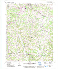
USGS Historical Quadrangle in GeoPDF.
This data release contains the boundaries of assessment units, assessment input data and resulting fact sheet data tables for the assessment of undiscovered oil and gas resources in the Mesozoic petroleum systems of the Central European Basin System. The Assessment Unit is the fundamental unit used in the National and Global Oil and Gas Assessment Project for the assessment of undiscovered oil and gas resources. The Assessment Unit is defined within the context of the higher-level Total Petroleum System. The Assessment Unit is shown herein as a geographic boundary interpreted, defined, and mapped by the geologist responsible for the province and incorporates a set of known or postulated oil and (or) gas accumulations...
The Assessment Unit is the fundamental unit used in the National Assessment Project for the assessment of undiscovered oil and gas resources. The Assessment Unit is defined within the context of the higher-level Total Petroleum System. The Assessment Unit is shown herein as a geographic boundary interpreted, defined, and mapped by the geologist responsible for the province and incorporates a set of known or postulated oil and (or) gas accumulations sharing similar geologic, geographic, and temporal properties within the Total Petroleum System, such as source rock, timing, migration pathways, trapping mechanism, and hydrocarbon type. The Assessment Unit boundary is defined geologically as the limits of the geologic...
Categories: Data;
Types: Downloadable,
Map Service,
OGC WFS Layer,
OGC WMS Layer,
Shapefile;
Tags: Assessment Unit,
Continuous Assessment Unit,
Earth Science,
Economic geology,
Energy Resources,
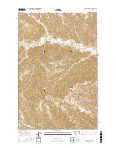
Layered GeoPDF 7.5 Minute Quadrangle Map. Layers of geospatial data include orthoimagery, roads, grids, geographic names, elevation contours, hydrography, and other selected map features.
Layered GeoPDF 7.5 Minute Quadrangle Map. Layers of geospatial data include orthoimagery, roads, grids, geographic names, elevation contours, hydrography, and other selected map features.
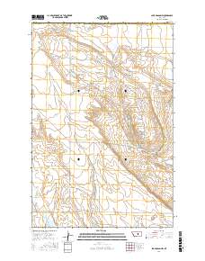
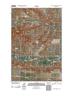
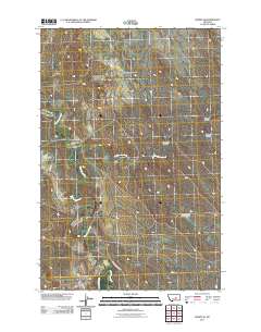
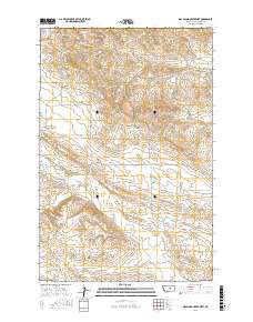
Layered geospatial PDF Map. Layers of geospatial data include orthoimagery, roads, grids, geographic names, elevation contours, hydrography, and other selected map features.
Layered geospatial PDF Map. Layers of geospatial data include orthoimagery, roads, grids, geographic names, elevation contours, hydrography, and other selected map features.
Layered geospatial PDF Map. Layers of geospatial data include orthoimagery, roads, grids, geographic names, elevation contours, hydrography, and other selected map features.
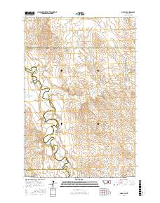
Layered geospatial PDF Map. Layers of geospatial data include orthoimagery, roads, grids, geographic names, elevation contours, hydrography, and other selected map features.
|

|
