Filters: Tags: petroleum (X)
431 results (32ms)|
Filters
Date Range
Extensions Types
Contacts
Categories
Tag Types Tag Schemes |
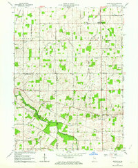
USGS Historical Quadrangle in GeoPDF.
Geospatial data is comprised of government boundaries.
The USGS Central Region Energy Team assesses oil and gas resources of the United States. The onshore and State water areas of the United States comprise 71 provinces. Within these provinces, Total Petroleum Systems are defined and Assessment Units are defined and assessed. Each of these provinces is defined geologically, and most province boundaries are defined by major geologic changes. The Wyoming Thrust Belt Province is located in southeastern Idaho, north central Utah, and southwestern Wyoming, encompassing all or parts of Bannock, Bear Lake, Bingham, Bonneville, Caribou, Franklin, Jefferson, Madison, and Teton Counties in Idaho and all or parts of Box Elder, Cache, Davis, Morgan, Rich, Salt Lake, Summit, and...
Categories: Data,
pre-SM502.8;
Types: Downloadable,
Map Service,
OGC WFS Layer,
OGC WMS Layer,
Shapefile;
Tags: 36 = Wyoming Thrust Belt,
50200101 = Thrust Belt Conventional,
50200281 = Frontier-Adaville-Evanstone Coalbed Gas,
503601 = Mowry Composite,
503602 = Frontier-Adaville-Evanston Coalbed Gas,
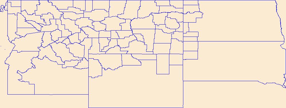
The USGS Central Region Energy Team assesses oil and gas resources of the United States. The onshore and State water areas of the United States comprise 71 provinces. Within these provinces, Total Petroleum Systems are defined and Assessment Units are defined and assessed. Each of these provinces is defined geologically, and most province boundaries are defined by major geologic changes. The Wind River Basin Province is located in central Wyoming, encompassing all or parts of Hot Springs,Fremont, and Natrona Counties. The main population centers within the study area are Casper, Riverton, and Thermopolis, Wyoming. The main highway, I-25 traverses the area to the east of the study area from north to south. The Wind...
https://www.ig.utexas.edu/research/projects/gbds/gbds.htm. For more information and discussion of the various depositional systems the user is referred to Galloway and others
The USGS Central Region Energy Team assesses oil and gas resources of the United States. The onshore and State water areas of the United States comprise 71 provinces. Within these provinces, Total Petroleum Systems are defined and Assessment Units are defined and assessed. Each of these provinces is defined geologically, and most province boundaries are defined by major geologic changes. The Illinois Basin Province is located in portions of Kentucky, Illinois, Indiana, Missouri, and Tennessee. The main population centers within the study area are Louisville, Kentucky; Peoria and Springfield Illinois; Indianapolis, Indiana; Saint Louis, Missouri; and Nashville, Tennessee. The main interstates, I-80, I-70, and I-40,...
Categories: Data,
pre-SM502.8;
Types: Downloadable,
Map Service,
OGC WFS Layer,
OGC WMS Layer,
Shapefile;
Tags: 506401 = Precambrian to Cambrian,
50640101 = Precambrian to Cambrian Rift-Fill,
50640102 = Cambrian Mount Simon to Eau Claire,
50640103 = Cambrian to Ordovician Knox Group,
506402 = Ordovician Ancell Maquoketa,
This shapefile includes polygons that describe U.S. Geological Survey defined geologic provinces that encompass northern Afghanistan.
Categories: Data,
pre-SM502.8;
Types: Downloadable,
Map Service,
OGC WFS Layer,
OGC WMS Layer,
Shapefile;
Tags: AF,
Afghan-Tajik basin,
Afghanistan Ministry of Mines and Industry,
Amu Darya basin,
Earth Science,
The structure contours were created using biostratigraphic data in the Paleo-Data, Inc., Tenroc Regional Geologic Database. The depths of the microfossil locations were associated with the wells data provided by the Louisiana Department of Natural Resources. Because of the proprietary nature of the Tenroc database, no actual data can be shown and only those data points contained in the Louisiana State wells database are included in the control points layer. Contouring was accomplished in Dynamic Graphics, Inc., EarthVision modeling software (v.5) using minimum tension gridding. Three custom programs were used to convert contour lines generated from grids in EarthVision to Arc/Info coverages and then to shapefiles....
Categories: Data,
pre-SM502.8;
Types: Downloadable,
Map Service,
OGC WFS Layer,
OGC WMS Layer,
Shapefile;
Tags: Coal,
Coalbed Methane,
Coalbed methane resources,
Contours,
Earth Science,
The geology data set for this map includes arcs, polygons, and labels that outline and describe the general geologic age and type of bedrock of Iran. The geologic provinces data set includes arcs, polygons, and labels of geologic and petroleum provinces interpreted and designated by R.M. Pollastro from a number of literature and map resources to assist in the assessment of oil and gas resources for the USGS World Energy Project. The oil and gas field centerpoints data set is a point coverage that marks the approximate centerpoints of oil and gas fields in Iran. Political boundaries are provided to show the general location of country and/or other reference 'political' boundaries.
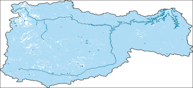
The National Hydrography Dataset (NHD) is a feature-based database that interconnects and uniquely identifies the stream segments or reaches that make up the nation's surface water drainage system. NHD data was originally developed at 1:100,000-scale and exists at that scale for the whole country. This high-resolution NHD, generally developed at 1:24,000/1:12,000 scale, adds detail to the original 1:100,000-scale NHD. (Data for Alaska, Puerto Rico and the Virgin Islands was developed at high-resolution, not 1:100,000 scale.) Local resolution NHD is being developed where partners and data exist. The NHD contains reach codes for networked features, flow direction, names, and centerline representations for areal water...
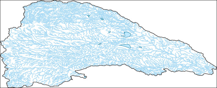
The National Hydrography Dataset (NHD) is a feature-based database that interconnects and uniquely identifies the stream segments or reaches that make up the nation's surface water drainage system. NHD data was originally developed at 1:100,000-scale and exists at that scale for the whole country. This high-resolution NHD, generally developed at 1:24,000/1:12,000 scale, adds detail to the original 1:100,000-scale NHD. (Data for Alaska, Puerto Rico and the Virgin Islands was developed at high-resolution, not 1:100,000 scale.) Local resolution NHD is being developed where partners and data exist. The NHD contains reach codes for networked features, flow direction, names, and centerline representations for areal water...
|

|
