Filters
Date Range
Extensions
Types
Contacts
Categories
Tag Types
Tag Schemes
|
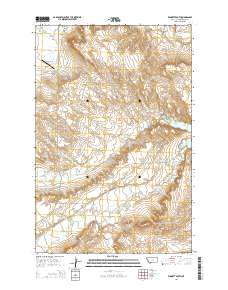
Layered GeoPDF 7.5 Minute Quadrangle Map. Layers of geospatial data include orthoimagery, roads, grids, geographic names, elevation contours, hydrography, and other selected map features.
Tags: 7.5 x 7.5 minute,
Downloadable Data,
EarthCover,
GeoPDF,
Imagery and Base Maps, All tags...
Map,
Montana,
Petroleum,
Public Land Survey System,
U.S. National Grid,
US,
US Topo,
US Topo Historical,
United States,
Winnett South, MT,
boundary,
contour,
geographic names,
hydrography,
imageryBaseMapsEarthCover,
orthoimage,
structures,
topographic,
transportation,
woodland, Fewer tags
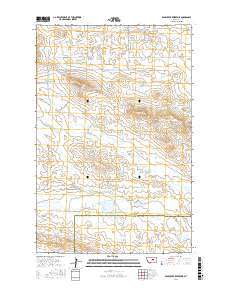
Layered geospatial PDF Map. Layers of geospatial data include orthoimagery, roads, grids, geographic names, elevation contours, hydrography, and other selected map features.
Tags: 7.5 x 7.5 minute,
Bear Creek Reservoir, MT,
Downloadable Data,
EarthCover,
Fergus, All tags...
GeoPDF,
Imagery and Base Maps,
Map,
Montana,
Petroleum,
Public Land Survey System,
U.S. National Grid,
US,
US Topo,
US Topo Historical,
United States,
boundary,
contour,
geographic names,
hydrography,
imageryBaseMapsEarthCover,
orthoimage,
structures,
topographic,
transportation,
woodland, Fewer tags
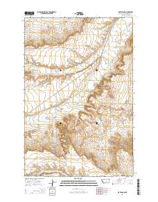
Layered GeoPDF 7.5 Minute Quadrangle Map. Layers of geospatial data include orthoimagery, roads, grids, geographic names, elevation contours, hydrography, and other selected map features.
Tags: 7.5 x 7.5 minute,
Downloadable Data,
EarthCover,
Flatwillow, MT,
GeoPDF, All tags...
Imagery and Base Maps,
Map,
Montana,
Petroleum,
Public Land Survey System,
U.S. National Grid,
US,
US Topo,
US Topo Historical,
United States,
boundary,
contour,
geographic names,
hydrography,
imageryBaseMapsEarthCover,
orthoimage,
structures,
topographic,
transportation,
woodland, Fewer tags
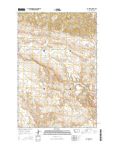
Layered GeoPDF 7.5 Minute Quadrangle Map. Layers of geospatial data include orthoimagery, roads, grids, geographic names, elevation contours, hydrography, and other selected map features.
Tags: 7.5 x 7.5 minute,
Cat Creek, MT,
Downloadable Data,
EarthCover,
GeoPDF, All tags...
Imagery and Base Maps,
Map,
Montana,
Petroleum,
Public Land Survey System,
U.S. National Grid,
US,
US Topo,
US Topo Historical,
United States,
boundary,
contour,
geographic names,
hydrography,
imageryBaseMapsEarthCover,
orthoimage,
structures,
topographic,
transportation,
woodland, Fewer tags

This shapefile contains points that describe the location of hydrocarbon exploration and production wells drilled in Afghanistan; and hyperlinks to scanned images of well logs that can be viewed in an ArcReader project.
Categories: Data,
pre-SM502.8;
Types: Downloadable,
Map Service,
OGC WFS Layer,
OGC WMS Layer,
Shapefile;
Tags: AF,
Afghan-Tajik basin, Province 1156,
Amu Darya basin, Province 1154,
Development wells,
Earth Science, All tags...
Exploration wells,
Geology,
Islamic State of Afghanistan,
Natural Gas,
Natural Resources,
Northern Afghanistan,
Oil,
Oil and gas wells,
Petroleum,
Production wells,
Resource assessment,
U.S. Geological Survey,
USGS,
USGS Science Data Catalog (SDC),
afghan,
geoscientificInformation,
oilgas,
wep,
worldgeologicmaps, Fewer tags

The data set for this coverage includes arcs, polygons, and polygon labels that outline and describe the general geologic age and type of bedrock of the Arabian Peninsula and selected adjacent areas. It also includes shoreline and inland water bodies. The Arabian Peninsula is part of Region 2 for the USGS World Energy Assessment.
Categories: Data,
pre-SM502.8;
Types: Downloadable,
Map Service,
OGC WFS Layer,
OGC WMS Layer,
Shapefile;
Tags: Anah Graben, Province 2089,
Arabian Peninsula,
Arabian Shield, Province 2101,
BA,
Bahrain, All tags...
Beirut, Province 2078,
Central Oman Platform, Province 2015,
Earth Science,
East Flank Oman Sub-basin, Province 2012,
Economic geology,
Euphrates/Mardin, Province 2075,
Fahud Salt Basin, Province 2016,
Geologic map,
Geology,
Geology,
Ghaba Salt Basin, Province 2014,
Ghudun-Khasfeh Flank, Province 2010,
Greater Ghawar Uplift, Province 2021,
Gulf of Oman Basin, Province 2018,
Hail-Ga'Ara Arch, Province 2025,
Haleb, Province 2076,
Hays Structural Belt, Province 2003,
Huqf-Haushi Uplift, Province 2013,
IS,
IZ,
Interior Homocline-Central Arch, Province 2020,
Iraq,
Israel,
JO,
Jafr-Tabuk Basin, Province 2026,
Jordan,
KU,
Khleisha Uplift, Province 2074,
Kingdom of Jordan,
Kingdom of Saudi Arabia,
Kuwait,
LE,
Lebanese Republic,
Lebanon,
Levantine Basin, Province 2032,
MU,
Ma'Rib-Al Jawf/Masila Basin, Province 2004,
Masila-Jeza Basin, Province 2009,
Masirah Trough, Province 2008,
Mesopotamian Foredeep Basin, Province 2024,
Middle East,
Mirbat Precambrian Basement, Province 2102,
Mukalla Rift Basin, Province 2005,
Natural Gas,
Natural Resources,
Natural gas resources,
North Harrah Volcanics, Province 2027,
Oil,
Oil sand resources,
Oil shale resources,
Oman,
Oman Mountains, Province 2017,
Palmyra Zone, Province 2077,
Petroleum,
QA,
Qatar,
Qatar Arch, Province 2022,
Red Sea Basin, Province 2071,
Region 2,
Republic of Iraq,
Republic of Yemen,
Resource Assessment,
Rub Al Khali Basin, Province 2019,
Rutbah Uplift, Province 2028,
SA,
Saudi Arabia,
Shabwah Basin, Province 2006,
Sharmah Rift Basin, Province 2007,
Sinai Basin, Province 2033,
South Harrah Volcanics, Province 2034,
South Oman Salt Basin, Province 2011,
South Yemen,
State of Bahrain,
State of Israel,
State of Kuwait,
State of Qatar,
Sultanate of Oman,
Syria,
Syrian Arab Republic,
TC,
U.S. Geological Survey,
USGS,
USGS Science Data Catalog (SDC),
United Arab Emirates,
Wadi-Surhan Basin, Province 2029,
Widyan Basin-Interior Platform, Province 2023,
YM,
Yemen,
Yemen Volcanic Basin (North), Province 2001,
Yemen Volcanic Basin (South), Province 2002,
Zagros Fold Belt, Province 2030,
Zagros Thrust Zone, Province 2031,
arabian,
environment,
geoscientificInformation,
oilgas,
wep,
worldgeologicmaps, Fewer tags

The USGS Central Region Energy Team assesses oil and gas resources of the United States. The onshore and State water areas of the United States comprise 71 provinces. Within these provinces, Total Petroleum Systems are defined and Assessment Units are defined and assessed. Each of these provinces is defined geologically, and most province boundaries are defined by major geologic changes. The Denver Basin Province is located in eastern Colorado, western Nebraska, southern South Dakota, and eastern Wyoming encompassing all or parts of Pueblo, El Paso, Crowley, Lincoln, Kit Carson, Elbert, Teller, Douglas, Jefferson, Denver, Arapahoe, Adams, Washington, Yuma, Morgan, Weld, Broomfield, Boulder, Larimer, Logan, Sedwick,...
Categories: Data,
pre-SM502.8;
Types: Downloadable,
Map Service,
OGC WFS Layer,
OGC WMS Layer,
Shapefile;
Tags: 39 = Denver Basin Province,
503901 = Coalbed Methane,
50390181 = Denver Formation Coals,
50390182 = Laramie Formation Coals,
503902 = Upper Cretaceous Fractured Niobrara, All tags...
50390201 = Fractured Niobrara Limestone Transitional,
50390261 = Fractured Niobrara Limestone (Silo Field Area),
503903 = Upper Cretaceous Pierre Shale,
50390361 = Fractured Pierre Shale,
503904 = Lower Cretaceous,
50390401 = Dakota Group and D Sandstone,
50390402 = Subthrust Structural,
503905 = Permian-Pennsylvanian,
50390501 = Permian-Pennsylvanian Reservoirs,
503906 = Cretaceous Composite,
50390601 = Pierre Shale Sandstones,
50390661 = Niobrara-Codell (Wattenberg Area),
50390662 = Dakota Group Basin-Center Gas,
503907 = Upper Cretaceous Niobrara Biogenic Gas,
50390761 = Niobrara Chalk,
CO,
Coalbed methane resources,
Colorado Plateau,
Colorado Plateau and Basin and Range,
Denver Basin,
Earth Science,
Economic geology,
Energy Resources,
Gas hydrate resources,
Geology,
Higley, Debra,
KS,
NE,
National Assessment of Oil and Gas,
Natural Gas,
Natural Resources,
Natural gas resources,
Oil,
Oil sand resources,
Oil shale resources,
Petroleum,
Province,
Resource Assessment,
SD,
Sedimentary Basin,
U.S. Geological Survey,
US08 = Colorado,
US20 = Kansas,
US31 = Nebraska,
US46 = South Dakota,
US56 = Wyoming,
USGS,
USGS Science Data Catalog (SDC),
USGS World Energy Region 5,
USGS World Energy Region 5,
United States,
WY,
geoscientificInformation,
noga2000,
nogadbasin,
oilgas, Fewer tags

These mapped faults are modified from Plate 2, Principal structural features, Gulf of Mexico Basin (compiled by T.E. Ewing and R.F. Lopez) in Volume J, The Geology of North America (1991); Plate 2, Geologic map of the U.S. Appalachians showing the Laurentian margin and the Taconic orogen (compiled by D.R. Rankin, A.A. Drake, and N.M. Ratcliffe) in Volume F-2, The Geology of North America (1989); and Plate 9, Tectonic map of the Ouachita orogen (compiled by W.A. Thomas) in Volume F-2, The Geology of North America (1989). This dataset contains basic data and interpretations developed and compiled by the U.S. Geological Survey's Framework Studies and Assessment of the Gulf Coast Project. Other major sources of data...
Categories: Data,
pre-SM502.8;
Types: Downloadable,
Map Service,
OGC WFS Layer,
OGC WMS Layer,
Shapefile;
Tags: AL,
AR,
Anticlines,
Coal,
Coalbed Methane, All tags...
Coalbed methane resources,
Earth Science,
Economic geology,
Energy Resources,
FL,
Geology,
Geology,
Gulf Coast,
Gulf Coast Framework Studies,
Gulf of Mexico,
LA,
MS,
Miocene,
Natural Gas,
Natural Resources,
Natural gas resources,
Oil,
Oil sand resources,
Petroleum,
Resource Assessment,
TX,
Tertiary Systems,
U.S. Geological Survey,
USGS,
USGS Science Data Catalog (SDC),
United States,
economy,
geoscientificInformation,
gulfcoastframework,
gulfroom,
oilgas, Fewer tags

These data provide generalized outlines of major basins and uplifts in the Gulf Coast region modified after Plate 2, Principal structural features, Gulf of Mexico Basin (compiled by T.E. Ewing and R.F. Lopez) in Volume J, The Geology of North America (1991). This dataset contains basic data and interpretations developed and compiled by the U.S. Geological Survey's Framework Studies and Assessment of the Gulf Coast Project. Other major sources of data include publicly available information from state agencies as well as publications of the U.S. Geological Survey and other scientific organizations. In cases where company proprietary data were used to produce various derivatives such as contour surfaces, the source...
Categories: Data,
pre-SM502.8;
Types: Downloadable,
Map Service,
OGC WFS Layer,
OGC WMS Layer,
Shapefile;
Tags: AL,
AR,
Basins,
Coal,
Coalbed Methane, All tags...
Coalbed methane resources,
Earth Science,
Economic geology,
Energy Resources,
FL,
Geology,
Geology,
Gulf Coast,
Gulf Coast Framework Studies,
Gulf of Mexico,
LA,
MS,
Miocene,
Natural Gas,
Natural Resources,
Natural gas resources,
Oil,
Oil sand resources,
Petroleum,
Resource Assessment,
TX,
Tertiary Systems,
U.S. Geological Survey,
USGS,
USGS Science Data Catalog (SDC),
United States,
Uplifts,
economy,
geoscientificInformation,
gulfcoastframework,
gulfroom,
oilgas, Fewer tags

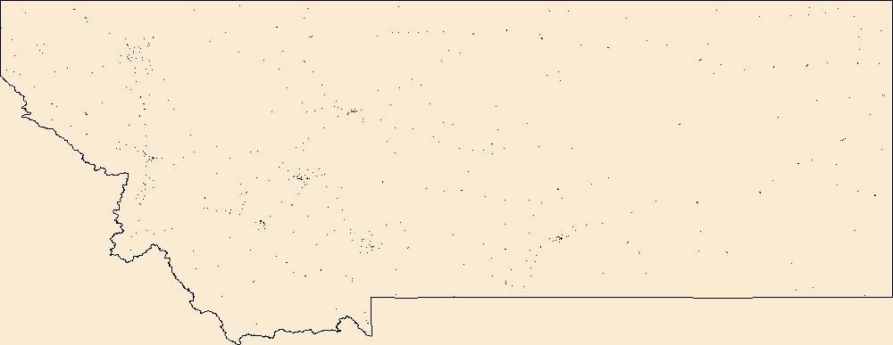
The USGS Central Region Energy Team assesses oil and gas resources of the United States. The onshore and State water areas of the United States comprise 71 provinces. Within these provinces, Total Petroleum Systems are defined and Assessment Units are defined and assessed. Each of these provinces is defined geologically, and most province boundaries are defined by major geologic changes. The Montana Thrust Belt Province is located in western Montana, encompassing all or parts of Beaverhead, Broadwater, Cascade, Deer Lodge, Flathead, Gallatin, Glacier, Granite, Jefferson, Lake, Lewis and Clark, Lincoln, Madison, Meagher, Mineral, Missoula, Park, Pondera, Powell, Ravalli, Sanders, Silver Bow, and Teton counties in...
Categories: Data,
pre-SM502.8;
Types: Downloadable,
Map Service,
OGC WFS Layer,
OGC WMS Layer,
Shapefile;
Tags: 27 = Montana Thrust Belt,
502701 = Thrust Belt Paleozoic/Mesozoic Composite,
50270101 = Thrust Belt Conventional Gas and Oil,
50270102 = Sawtooth Range Structure Conventional Oil and Gas,
50270103 = Frontal Structures Conventional Oil and Gas, All tags...
502702 = Central Montana Trough Paleozoic Composite,
50270201 = Helena Salient Conventional Oil and Gas,
502703 = Bakken,
50270361 = Bakken Continuous Oil,
502704 = Blacktail Salient Paleozoic Composite,
50270401 = Blacktail Salient Conventional Oil and Gas,
502705 = Marias River Shale,
50270561 = Marias River Shale Continuous Oil,
502706 = Mesozoic Coal,
50270681 = Jurassic-Cretaceous Coalbed Methane,
502707 = Tertiary Lacustrine Shale,
50270701 = Tertiary Basins Oil and Gas,
Coalbed methane resources,
Earth Science,
Economic geology,
Energy Resources,
Gas hydrate resources,
Geology,
ID,
MT,
Montana Thrust Belt,
National Assessment of Oil and Gas,
Natural Gas,
Natural Resources,
Natural gas resources,
Oil,
Oil sand resources,
Oil shale resources,
Petroleum,
Province,
Resource Assessment,
Rocky Mountains and Northern Great Plains,
Schenk, C. J.,
Sedimentary Basin,
U.S. Geological Survey,
US16 = Idaho,
US30 = Montana,
USGS,
USGS Science Data Catalog (SDC),
USGS World Energy Region 5,
USGS World Energy Region 5,
United States,
geoscientificInformation,
noga2000,
nogathrustbelt,
oilgas, Fewer tags

The USGS Central Region Energy Team assesses oil and gas resources of the United States. The onshore and State water areas of the United States comprise 71 provinces. Within these provinces, Total Petroleum Systems are defined and Assessment Units are defined and assessed. Each of these provinces is defined geologically, and most province boundaries are defined by major geologic changes. The Southwestern Wyoming Province is located in northeastern Utah, northwestern Colorado and southwestern Wyoming, encompassing all or parts of Eagle, Garfield, Moffat, Rio Blanco, and Routt Counties in Colorado and all or parts of Carbon, Fremont, Lincoln, Sweetwater, Sublette, Teton, and Uintah Counties in Wyoming and all or parts...
Categories: Data,
pre-SM502.8;
Types: Downloadable,
Map Service,
OGC WFS Layer,
OGC WMS Layer,
Shapefile;
Tags: 503701 = Phosphoria Total Petroleum System,
50370101 = Sub-Cretaceous Conventional Oil and Gas,
503702 = Mowry Composite Total Petroleum System,
50370201 = Mowry Conventional Oil and Gas,
50370261 = Mowry Continuous Gas, All tags...
503703 = Niobrara Total Petroleum System,
50370361 = Niobrara Continuous Oil,
50370362 = Niobrara Continuous Gas,
503704 = Hilliard-Baxter-Mancos Total Petroleum System,
50370401 = Hilliard-Baxter-Mancos Conventional Oil and Gas,
50370461 = Hilliard-Baxter-Mancos Continuous Gas,
503705 = Mesaverde Total Petroleum System,
50370501 = Mesaverde Conventional Oil and Gas,
50370561 = Almond Continuous Gas,
50370562 = Rock Springs-Ericson Continuous Gas,
50370581 = Mesaverde Coalbed Gas,
503706 = Mesaverde-Lance-Fort Union Composite Total Petroleum System,
50370601 = Mesaverde-Lance-Fort Union Conventional Oil and Gas,
50370661 = Mesaverde-Lance-Fort Union Continuous Gas,
50370681 = Mesaverde Coalbed Gas,
50370682 = Fort Union Coalbed Gas,
503707 = Lewis Total Petroleum System,
50370701 = Lewis Conventional Oil and Gas,
50370761 = Lewis Continuous Gas,
503708 = Lance-Fort Union Composite Total Petroleum System,
50370801 = Lance-Fort Union Conventional Oil and Gas,
50370861 = Lance-Fort Union Continuous Gas,
50370881 = Lance Coalbed Gas,
50370882 = Fort Union Coalbed Gas,
503709 = Wasatch-Green River Composite Total Petroleum System,
50370961 = Wasatch-Green River Continuous Gas,
50370981 = Wasatch-Green River Coalbed Gas,
CO,
Coalbed methane resources,
Earth Science,
Economic geology,
Energy Resources,
Gas hydrate resources,
Geology,
Kirschbaum, M.A.,
National Assessment of Oil and Gas,
Natural Gas,
Natural Resources,
Natural gas resources,
Oil,
Oil sand resources,
Oil shale resources,
Petroleum,
Province,
Resource Assessment,
Sedimentary Basin,
Southwestern Wyoming,
Southwestern Wyoming,
U.S. Geological Survey,
US08 = Colorado,
US49 = Utah,
US56 = Wyoming,
USGS,
USGS Science Data Catalog (SDC),
USGS World Energy Region 5,
USGS World Energy Region 5,
UT,
United States,
WY,
geoscientificInformation,
noga2000,
nogasw,
oilgas, Fewer tags

This coverage includes arcs, polygons and polygon labels that describe Arctic portion of the U.S. Geological Survey defined geologic provinces of the World in 2000.
Categories: Data,
pre-SM502.8;
Types: Downloadable,
Map Service,
OGC WFS Layer,
OGC WMS Layer,
Shapefile;
Tags: Admiralty Arch, Province 1061,
Anabar Basin, Province 1200,
Anabar-Olenek High, Province 1202,
Anadyr Basin, Province 1300,
Anzhu Uplift, Province 1255, All tags...
Arctic,
Arctic Coastal Shelf, Province 5241,
Arctic Ocean Slope, Province 1117,
Ayon Basin, Province 1253,
Baffin Basin, Province 5207,
Baltic Shield-Norwegian Caledonides, Province 4016,
Banks Basin, Province 5233,
Barents Continental Slope, Province 4013,
Beaufort Shelf OCS, Province 5081,
Blagoveshchensk Basin, Province 1254,
Boothia Basin, Province 5230,
Canada Basin-Beaufort Slope OCS, Province 5079,
Canadian Cordillera, Province 5248,
Canadian Shield, Province 5226,
Central Alaska, Province 5002,
Central Barents Platform, Province 4012,
Central Kara High, Province 1070,
Chukchi Borderland OCS, Province 5078,
Chukchi Shelf OCS, Province 5080,
Cornwallis Foldbelt, Province 5237,
De Long High, Province 1257,
Earth Science,
East Greenland Foldbelt, Province 5201,
East Greenland Rift Basins, Province 5200,
Economic geology,
Ellesmere Foldbelt, Province 5238,
Foxe Basin, Province 5229,
Gas province,
Gas resource assessment,
Geologic province,
Geology,
Greenland Shield, Province 5202,
Grumant Uplift, Province 1064,
Hammerfest-Varanger Basin, Province 4015,
Hope Basin OCS, Province 5082,
Hudson Bay Basin, Province 5228,
Kane Basin, Province 5206,
Kempendiay Region, Province 1212,
Khatanga Saddle, Province 1201,
Kola Monocline-Finnmark Platform, Province 1051,
Koryak-Kamchatka Foldbelt, Province 1304,
Labrador-Newfoundland Shelf, Province 5215,
Laptev Shelf, Province 1218,
Lena-Vilyuy Basin, Province 1214,
Ludlov Saddle, Province 1059,
Mackenzie Delta Slope, Province 5240,
Mackenzie Delta, Province 5239,
Mackenzie Foldbelt, Province 5246,
Mezen Basin, Province 1006,
Minto Arch, Province 5235,
Moma Basin, Province 1252,
Natural Gas,
Natural Resources,
Natural gas liquids resource assessment,
Natural gas resources,
Nepa-Botuoba Arch, Province 1210,
North Barents Basin, Province 1060,
North Chukchi Basin, Province 1258,
North Greenland Foldbelt, Province 5204,
North Greenland Platform, Province 5203,
North Novaya Zemlya Basin, Province 1065,
Northern Alaska, Province 5001,
Northern Interior Basins, Province 5242,
Norton Basin OCS, Province 5086,
Novaya Zemlya Monocline, Province 1062,
Novosibirsk Basin, Province 1256,
Oil,
Oil and gas province,
Oil and gas resource assessment,
Oil province,
Oil resource assessment,
Oil sand resources,
Oil shale resources,
Parry Island Foldbelt, Province 5236,
Penzhina Basin, Province 1303,
Petroleum,
Resource Assessment,
Schmidt Basin, Province 1071,
Severnaya Zemlya High, Province 1072,
South Arctic Basin, Province 5231,
South Barents Basin, Province 1050,
South Chukchi-Hope Basin, Province 1261,
Southeast Greenland Basin, Province 5209,
St. Anna Basin, Province 1066,
Svalbard High, Province 4011,
Sverdrup Basin, Province 5234,
Taimyr-Kara High, Province 1176,
Timan High, Province 1007,
Timan-Pechora Basin, Province 1008,
Troms-Bjornoya, Province 4014,
Tunguska Basin, Province 1203,
Turukhan-Igarka Uplift, Province 1205,
Turukhan-Norilsk Folded Zone, Province 1204,
U.S. Geological Survey,
USGS,
USGS Science Data Catalog (SDC),
Uedineniya Basin, Province 1069,
Ural-Novaya Zemlya Foldbelt, Province 1017,
Ushakov High, Province 1068,
Verkhoyan-Chukotka Folded Region, Province 1250,
Vestford-Helgeland, Province 4017,
Vize High, Province 1067,
Wandel Sea Basin, Province 5205,
West Greenland Basin, Province 5208,
West Siberian Basin, Province 1174,
Wollaston Basin, Province 5232,
Wrangel Basin, Province 1259,
Wrangel-Herald Uplift, Province 1260,
Yenisey-Khatanga Basin, Province 1175,
Yukon Basin, Province 5247,
Zyryanka Basin, Province 1251,
arctic,
environment,
geoscientificInformation,
oilgas,
wep,
worldgeologicmaps, Fewer tags

The structure contours were created using biostratigraphic data in the Paleo-Data, Inc., Tenroc Regional Geologic Database. The depths of the microfossil locations were associated with the wells data provided by the Louisiana Department of Natural Resources. Because of the proprietary nature of the Tenroc database, no actual data can be shown and only those data points contained in the Louisiana State wells database are included in the control points layer. Contouring was accomplished in Dynamic Graphics, Inc., EarthVision modeling software (v.5) using minimum tension gridding. Three custom programs were used to convert contour lines generated from grids in EarthVision to Arc/Info coverages and then to shapefiles....
Categories: Data,
pre-SM502.8;
Types: Downloadable,
Map Service,
OGC WFS Layer,
OGC WMS Layer,
Shapefile;
Tags: Coal,
Coalbed Methane,
Coalbed methane resources,
Contours,
Earth Science, All tags...
Economic geology,
Energy Resources,
Geology,
Gulf Coast,
Gulf Coast Framework Studies,
LA,
Louisiana,
Miocene,
Natural Gas,
Natural Resources,
Natural gas resources,
Oil,
Oil sand resources,
Petroleum,
Resource Assessment,
Surface,
Tertiary Systems,
U.S. Geological Survey,
USGS,
USGS Science Data Catalog (SDC),
United States,
economy,
geoscientificInformation,
gulfcoastframework,
gulfroom,
oilgas, Fewer tags

The Assessment Unit is the fundamental unit used in the National Assessment Project for the assessment of undiscovered oil and gas resources. The Assessment Unit is defined within the context of the higher-level Total Petroleum System. The Assessment Unit is shown herein as a geographic boundary interpreted, defined, and mapped by the geologist responsible for the province and incorporates a set of known or postulated oil and (or) gas accumulations sharing similar geologic, geographic, and temporal properties within the Total Petroleum System, such as source rock, timing, migration pathways, trapping mechanism, and hydrocarbon type. The Assessment Unit boundary is defined geologically as the limits of the geologic...
Categories: Data,
pre-SM502.8;
Types: Downloadable,
Map Service,
OGC WFS Layer,
OGC WMS Layer,
Shapefile;
Tags: Appalachian Basin,
Assessment Unit,
Chattanooga Plateau Shale Gas,
Chattanooga Plateau Shale Oil,
Continuous Assessment Unit, All tags...
Devonian Foldbelt Shale Gas,
Earth Science,
Economic geology,
Energy Resources,
Geology,
NOGA2000,
National Assessment of Oil and Gas,
Natural Gas,
Natural Resources,
Natural gas resources,
Oil,
Oil resources,
OilGas,
Resource Assessment,
State of Alabama,
State of Georgia,
State of Kentucky,
State of Mississippi,
State of Ohio,
State of Pennsylvania,
State of Tennessee,
State of Virginia,
State of West Virginia,
Sunbury Shale Gas,
Sunbury Shale Oil,
U.S. Geological Survey,
U.S.A.,
USGS,
USGS Science Data Catalog (SDC),
USGS World Energy Region 5,
USGS World Energy Region 5,
Unconventional Assessment Unit,
United States,
United States of America,
energy resources,
geoscientificInformation,
natural gas resources,
oil resources,
petroleum, Fewer tags

This data release contains the boundaries of assessment units and input data for the assessment of undiscovered continuous oil and gas in the Upper Cretaceous Tuscaloosa Marine shale of the U.S. Gulf Coast. The Assessment Unit is the fundamental unit used in the National Assessment Project for the assessment of undiscovered oil and gas resources. The Assessment Unit is defined within the context of the higher-level Total Petroleum System. The Assessment Unit is shown herein as a geographic boundary interpreted, defined, and mapped by the geologist responsible for the province and incorporates a set of known or postulated oil and (or) gas accumulations sharing similar geologic, geographic, and temporal properties...
Categories: Data;
Types: Downloadable,
Map Service,
OGC WFS Layer,
OGC WMS Layer,
Shapefile;
Tags: Assessment Unit,
Continuous Assessment Unit,
Energy Resources,
Energy Resources,
Geology, All tags...
NOGA2000,
National Assessment of Oil and Gas,
Natural Gas,
Oil,
OilGas,
Resource Assessment,
State of Alabama,
State of Florida,
State of Louisiana,
State of Mississippi,
Tuscaloosa Marine Shale Continuous Oil,
USGS Science Data Catalog (SDC),
Unconventional Assessment Unit,
United States of America,
energy resources,
geoscientificInformation,
natural gas resources,
oil resources,
petroleum, Fewer tags
Geospatial data includes structures and other selected map features.
Tags: Beaverhead,
Big Horn,
Blaine,
Broadwater,
Campground, All tags...
Carbon,
Carter,
Cascade,
Chouteau,
College / University,
Courthouse,
Custer,
Daniels,
Dawson,
Deer Lodge,
Downloadable Data,
Esri Shapefile nan,
Fallon,
Fergus,
Fire Station/ EMS Station,
Flathead,
Gallatin,
Garfield,
Glacier,
Golden Valley,
Granite,
Hill,
Hospital/Medical Center,
Information Center,
Jefferson,
Judith Basin,
Lake,
Law Enforcement,
Lewis and Clark,
Liberty,
Lincoln,
MT,
Madison,
McCone,
Meagher,
Mineral,
Missoula,
Montana,
Musselshell,
National Structures Dataset (NSD),
National Structures Dataset (NSD),
Park,
Petroleum,
Phillips,
Pondera,
Post Office,
Powder River,
Powell,
Prairie,
Prison/ Correctional Facility,
Ravalli,
Richland,
Roosevelt,
Rosebud,
Sanders,
School,
School:Elementary,
School:High School,
School:Middle School,
Shapefile,
Sheridan,
Silver Bow,
State,
State,
State Capitol,
Stillwater,
Structures,
Sweet Grass,
Technical School,
Teton,
Toole,
Town Hall,
Trade School,
Trailhead,
Treasure,
US,
United States,
Valley,
Visitor Center,
Wheatland,
Wibaux,
Yellowstone,
structure, Fewer tags
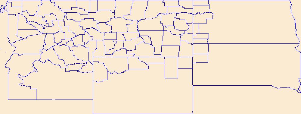
Geospatial data is comprised of government boundaries.
Tags: Beaverhead,
Big Horn,
Blaine,
Boundaries,
Broadwater, All tags...
Carbon,
Carter,
Cascade,
Chouteau,
County or Equivalent,
Custer,
Daniels,
Dawson,
Deer Lodge,
Downloadable Data,
Esri Shapefile nan,
Fallon,
Fergus,
Flathead,
Gallatin,
Garfield,
Glacier,
Golden Valley,
Granite,
Hill,
Incorporated Place,
Jefferson,
Judith Basin,
Jurisdictional,
Lake,
Lewis and Clark,
Liberty,
Lincoln,
MT,
Madison,
McCone,
Meagher,
Mineral,
Minor Civil Division,
Missoula,
Montana,
Musselshell,
National Boundary Dataset (NBD),
National Boundary Dataset (NBD),
Native American Area,
PLSS First Division,
PLSS Special Survey,
PLSS Township,
Park,
Petroleum,
Phillips,
Pondera,
Powder River,
Powell,
Prairie,
Public Land Survey System,
Ravalli,
Reserve,
Richland,
Roosevelt,
Rosebud,
Sanders,
Shapefile,
Sheridan,
Silver Bow,
State,
State,
State or Territory,
Stillwater,
Sweet Grass,
Teton,
Toole,
Treasure,
U.S. National Grid,
US,
Unincorporated Place,
United States,
Valley,
Wheatland,
Wibaux,
Yellowstone,
boundaries,
boundary,
cadastral surveys,
geographic names,
land ownership,
land use maps,
legal land descriptions,
political and administrative boundaries,
zoning maps, Fewer tags
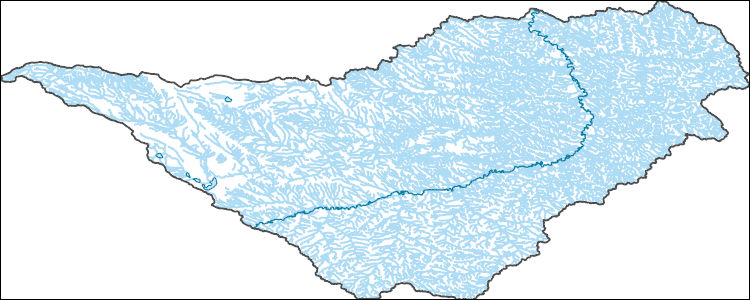
The National Hydrography Dataset (NHD) is a feature-based database that interconnects and uniquely identifies the stream segments or reaches that make up the nation's surface water drainage system. NHD data was originally developed at 1:100,000-scale and exists at that scale for the whole country. This high-resolution NHD, generally developed at 1:24,000/1:12,000 scale, adds detail to the original 1:100,000-scale NHD. (Data for Alaska, Puerto Rico and the Virgin Islands was developed at high-resolution, not 1:100,000 scale.) Local resolution NHD is being developed where partners and data exist. The NHD contains reach codes for networked features, flow direction, names, and centerline representations for areal water...
Tags: Administrative watershed units,
Administrative watershed units,
Area of Complex Channels,
Area to be submerged,
Basin, All tags...
Basin,
Bay/Inlet,
Boundaries,
Boundary,
Bridge,
Canal/Ditch,
Coastline,
Connector,
Dam/Weir,
Downloadable Data,
Drainage areas for surface water,
Drainageway,
Esri File GeoDatabase 10,
Estuary,
Fergus,
FileGDB,
Flow direction network,
Flume,
ForeShore,
Gaging Station,
Garfield,
Gate,
Golden Valley,
HU-8,
HU-8 Subbasin,
HU10,
HU12,
HU14,
HU16,
HU2,
HU4,
HU6,
HU8,
HU8_10040202,
HUC,
Hazard Zone,
Hydrographic,
Hydrography,
Hydrography,
Hydrography,
Hydrologic Unit Code,
Hydrologic Units,
Ice mass,
Inundation Area,
Levee,
Line,
Lock Chamber,
MT,
Marsh,
Montana,
Musselshell,
National Hydrography Dataset (NHD),
National Hydrography Dataset (NHD) Best Resolution,
National Hydrography Dataset (NHD) Best Resolution,
Nonearthen Shore,
Orthoimage,
Petroleum,
Playa,
Point,
PointEvent,
Pond,
Rapids,
Rapids,
Reach,
Reach code,
Reef,
Region,
Reservoir,
Rock,
Rosebud,
Sea/Ocean,
Sink/Rise,
Sounding Datum Line,
Special Use Zone,
Special Use Zone Limit,
Spillway,
Stream,
Stream/River,
Sub-basin,
Sub-region,
Subbasin,
Submerged Stream,
Subregion,
Subwatershed,
Surface water systems,
Swamp,
Topographic,
Tunnel,
US,
Underground Conduit,
United States,
WBD,
WBD,
Wall,
Wash,
Water Intake Outflow,
Waterfall,
Watershed,
Watershed Boundaries,
Watershed Boundary Dataset,
Watershed Boundary Dataset,
Well,
Yellowstone,
artificial path,
boundaries,
dams,
drainage systems and characteristics,
inlandWaters,
lakes,
ngda,
rivers, Fewer tags

This data release contains the boundaries of assessment units, assessment input data, and resulting fact sheet data tables for the assessment of undiscovered oil and gas resources in the presalt reservoirs of the West-Central Coastal Province of Africa. The Assessment Unit is the fundamental unit used in the National and Global Oil and Gas Assessment Project for the assessment of undiscovered oil and gas resources. The Assessment Unit is defined within the context of the higher-level Total Petroleum System. The Assessment Unit is shown herein as a geographic boundary interpreted, defined, and mapped by the geologist responsible for the province and incorporates a set of known or postulated oil and (or) gas accumulations...
Categories: Data;
Types: Downloadable,
Map Service,
OGC WFS Layer,
OGC WMS Layer,
Shapefile;
Tags: Angola,
Assessment Unit,
Cameroon,
Congo,
Congo Basin Presalt Reservoirs, All tags...
Conventional Assessment Unit,
Democratic Republic of the Congo,
Douala-Rio Muni Basin Presalt Reservoirs,
Energy Resources,
Energy Resources,
Equatorial Guinea,
Gabon,
Gabon Basin Presalt Reservoirs,
Geology,
Kwanza-Benguela Basin Presalt Reservoirs,
NOGA2000,
Namibe Basin Presalt Reservoirs,
Namibia,
National Assessment of Oil and Gas,
Natural Gas,
Oil,
OilGas,
Resource Assessment,
USGS Science Data Catalog (SDC),
energy resources,
geoscientificInformation,
natural gas resources,
oil resources,
petroleum, Fewer tags

The U.S. Geological Survey (USGS) has compiled a geodatabase containing mineral-related geospatial data for the People's Republic of China. The data can be used in analyses of the extractive fuel and nonfuel mineral industries and related economic and physical infrastructure integral for the successful operation of the mineral industries within the area of study as well as the movement of mineral products across domestic and global markets. This geodatabase reflects the USGS ongoing commitment to its mission of understanding the nature and distribution of global mineral commodity supply chains by updating and publishing the georeferenced locations of mineral commodity production and processing facilities, mineral...
Tags: Asia,
China,
Economic Geology,
Energy Resources,
Fujian Province, All tags...
GIS,
Geography,
Guangdong Province,
Guanxi Zhuang Autonomous Region,
Hainan Province,
Hebei Province,
Hunan Province,
Information Sciences,
Jiangsu Province,
LNG,
Mineral Resources,
NGL,
PGE,
REE,
Shandong Province,
South China Sea,
Tianjin Municipality,
USGS Science Data Catalog (SDC),
Zhejiang Province,
aluminum,
amethyst,
antimony,
antimony occurrence,
antimony resources,
aquamarine,
aragonite,
arsenic,
asbestos,
barite,
barium,
bauxite,
beforsite,
bentonite,
beryl beryllium,
bismuth,
boron,
brine,
brown coal,
bulk cargo,
bulk shipping,
cadmium,
calcium,
celestite,
cement,
cesium,
chromium,,
clay,
coal,
coal (brown),
coal (hard),
coal occurrence,
coal resources,
coalbed methane,
coalfield,
cobalt,
columbium,
commodity,
continuous resources,
conventional resources,
copper,
copper occurrence,
copper resources,
dam,
deposit,
diamond,
electrical transmission lines,
electricity,
electricity generation,
emerald,
energy,
energy generation,
epidote,
evaporite-related potash,
exploration,
extra high voltage,
ferroalloys,
floating storage,
fluorite,
fluorspar,
fluxstone,
gallium,
garnet,
gas,
gas production,
gas terminal,
gemstone,
gemstones,
geography,
gold,
graphite,
gypsum,
hafnium,
halite,
halite (brine),
hard coal,
hydrocarbon resources,
iron,
iron (carbonatite),
iron and steel,
iron ore,
kyanite,
lapiz lazuli,
lead,
limestone,
liquefied natural gas (LNG),
lithium,
magnesite,
magnesium,
manganese,
marble,
maritime port,
mercury,
methanol,
mica,
mine,
mineral,
mineral commodity,
mineral deposit,
mineral exploration,
mineral exports,
mineral occurrence,
mineral processing,
mineral resources,
minerals,
mining,
mining exploration,
molybdenum,
morganite,
muscovite,
natural gas,
natural gas liquids (NGL),
nickel,
niobium,
niobium (columbium),
non-renewable energy,
ochre,
oil,
oil and gas,
oil and gas terminal,
oil production,
oil terminal,
onshore,
peat,
petroleum,
phosphate,
phosphate occurrence,
phosphate resources,
phosphorite,
phosphorus,
platinum-group elements,
porphyry copper,
port,
port terminal,
potash,
potash occurrence,
potash resources,
potassium,
power,
power generation,
power lines,
power plant,
power station,
power transmission,
quartz,
rare earth elements,
recoverable resources,
refinery,
refining,
regasification,
regasification unit (FSRU),
renewable energy,
resources,
rhenium,
rose quartz,
rubidium,
ruby,
salt,
sand,
sand (glass),
sand and gravel,
sandstone,
sapphire,
sediment-hosted stratabound copper,
selenium,
serpentine,
shale gas,
shale oil,
shipping port,
silica,
silver,
smelting,
sodium,
sphalerite,
spinel,
strontium,
sulfur,
sövite,
talc,
tantalum,
technetium,
tellurium,
terminal,
thorium,
tight gas,
tight oil,
tin,
titanium,
tourmaline,
transmission lines,
tungsten,
ultra high voltage,
unconventional resources,
undiscovered resources,
uranium,
vanadium,
vermiculite,
water storage,
zinc,
zirconium, Fewer tags
|
|

