Alaska Orthorectified Radar Intensity Image - USGS National Map 3DEP Downloadable Data Collection
Dates
Publication Date
2022
Start Date
2010
End Date
2022
Citation
U.S. Geological Survey, 2022, Alaska Orthorectified Radar Intensity Image - USGS National Map 3DEP Downloadable Data Collection: U.S. Geological Survey.
Summary
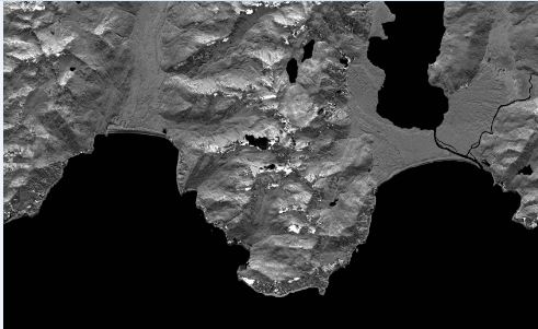
These data are orthorectified radar intensity images (ORI) derived from interferometric synthetic aperture radar (ifsar) data. An ORI is a high-resolution image derived from ifsar which has geometric distortions removed. Unlike optical imagery, ifsar can be collected in cloudy conditions. The USGS performs minimal quality assurance and no reprocessing of the ORI data. USGS distributes the ORI data as received from the contractors, partners or contributing entities.
Summary
These data are orthorectified radar intensity images (ORI) derived from interferometric synthetic aperture radar (ifsar) data. An ORI is a high-resolution image derived from ifsar which has geometric distortions removed. Unlike optical imagery, ifsar can be collected in cloudy conditions. The USGS performs minimal quality assurance and no reprocessing of the ORI data. USGS distributes the ORI data as received from the contractors, partners or contributing entities.
ORIs are used as a primary or ancillary source for digital mapping. They are also used for georeferencing aerial and satellite imagery. Since ORIs highlight topological features they are useful for land cover classification and analysis.