Folders: ROOT > ScienceBase Catalog > LC MAP - Landscape Conservation Management and Analysis Portal > North Pacific Landscape Conservation Cooperative > Data Inventory ( Show direct descendants )
823 results (15ms)
Location
Folder
ROOT _ScienceBase Catalog __LC MAP - Landscape Conservation Management and Analysis Portal ___North Pacific Landscape Conservation Cooperative ____Data Inventory Filters
Date Range
Extensions
Types
Contacts
Categories Tag Types
|

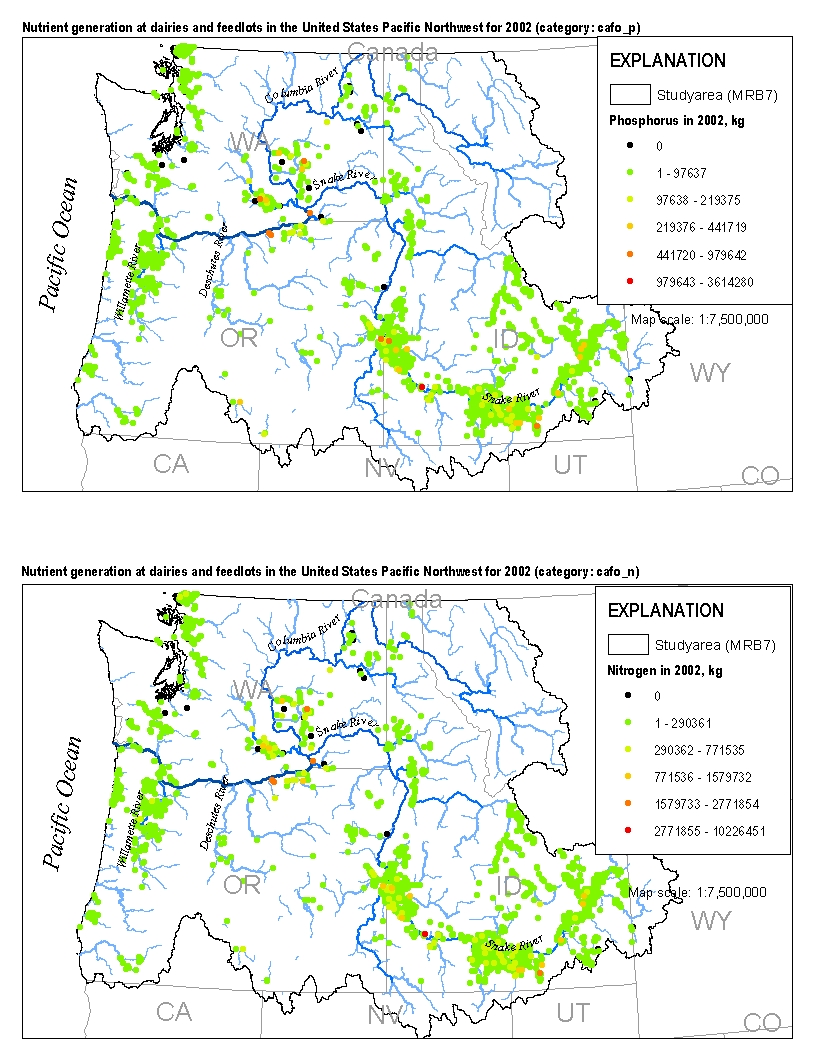
This spatial data set was created by the U.S. Geological Survey (USGS) to represent the amount of nitrogen and phosphorus generated by cattle at dairies and feedlots in the Pacific Northwest region of the United States (Hydro Region 17; Major River Basin 7 (MRB7)) during 2002.

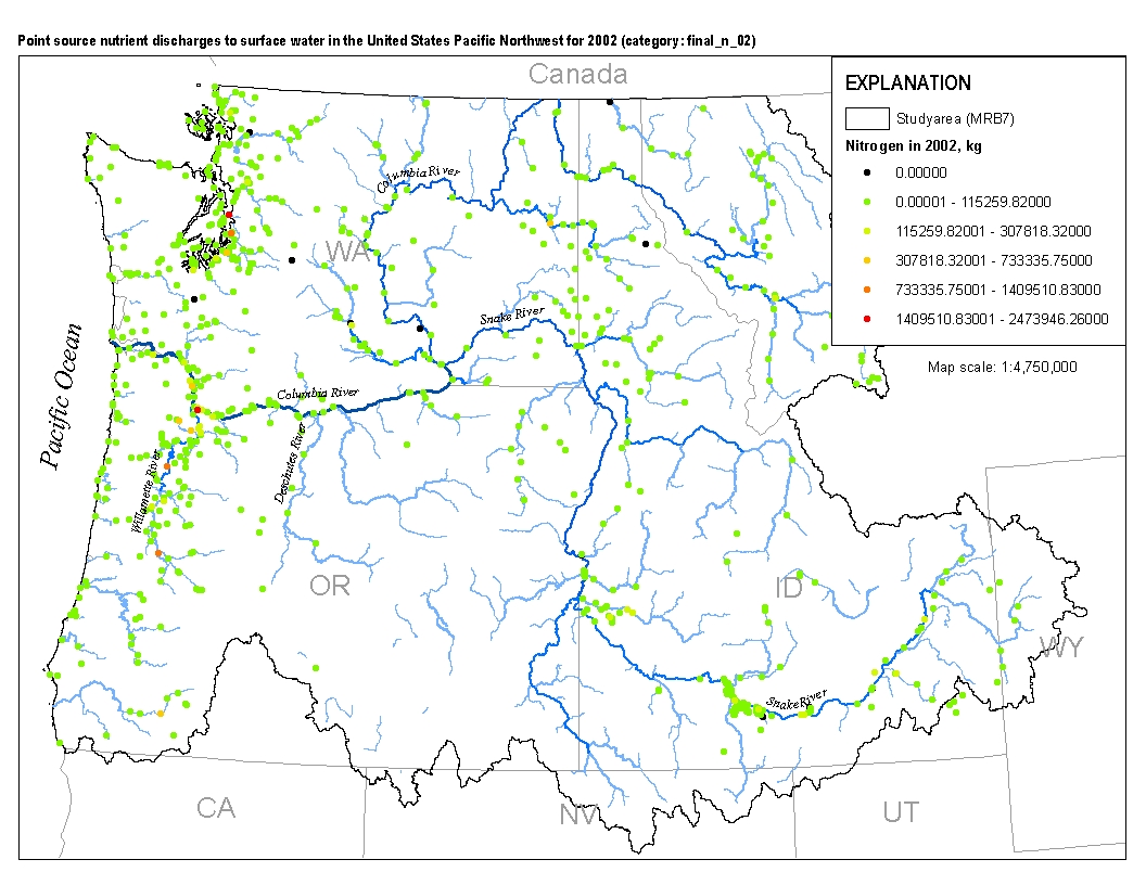
This spatial data set was created by the U.S. Geological Survey (USGS) to represent the amount of total nitrogen and total phosphorus discharged to surface waters in the Pacific Northwest region of the United States (Hydro Region 17; Major River Basin 7 (MRB7)) during 2002 from individual permitted wastewater facilities.

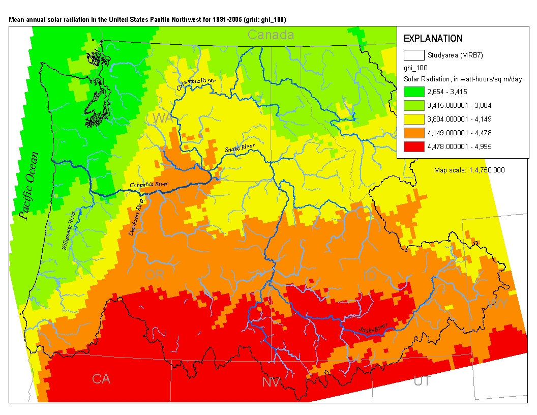
This spatial data set was created by the U.S. Geological Survey (USGS) to represent mean annual solar radiation in the Pacific Northwest region of the United States (Hydro Region 17; Major River Basin 7 (MRB7)) for the period between 1991 and 2005.
Fifth Field Hydrologic Units (watersheds) polygons for the Chum Salmon population and distribution within the Western Oregon Plan Revision (WOPR) area.BLM (Bureau of Land Management), WOPR (Western Oregon Plan Revision) WOPR Theme Group: FSH (Fish) PRMP: (Proposed Resource Management Plan) WOPR Purpose: A (Analysis) HUC (Hydrologic Unit Code) CHART (Critical Habitat Analytical Review Team) This data is a PRMP release version of the data fsh_aa_a_Chumhuc5_chart_poly.
OPTIONS model- post processing- of structural stages, stand age, and Northern Spotted Owl (NSO) habitat index at years 0, 10, 20, 30, 40, 50, 100 for the Salem Sustained Yield Unit (SYU) portion of the Western Oregon Plan Revision (WOPR) area. *See Appendix R of the Western Oregon Plan Revision Proposed Resource Managemnt Plan for further description.BLM (Bureau of Land Management) WOPR (Western Oregon Plan Revision) WOPR Theme Group: OPT (Options) WOPR Purpose: O (Options) GLUA: General Land Use Allocations PRMP: Proposed Resource Management Plan ASQ (Allowable Sale Quantity) SYU (Sustained Yield Unit) ESC (Existing Stand Condition) M4C WPR_ID (a unique identifier generated in the options harvest model preparation...
Fifth Field Hydrologic Units (watersheds) polygons for the Chinook Salmon population and distribution within the Western Oregon Plan Revision (WOPR) area.BLM (Bureau of Land Management) WOPR (Western Oregon Plan Revision) PRMP (Proposed Resource Management Plan) WOPR Theme Group: FSH (Fish) WOPR Purpose: A (Analysis) HUC (Hydrologic Unit Code) CHART (Critical Habitat Analytical Review Team) This data is a PRMP release version of the data fsh_aa_a_chinookhuc5_chart_poly.
This theme maps Late-Successional Reserves associated with occupied marbled murrelet sites. The criteria for mapping these areas are identified on pages C-10 of the Northwest Forest Plan Standards and Guidelines( See Supplemental Info). Supplemental direction to the administrative units in BLM IM OR-2003-001 stated that protection will be afforded to all contiguous existing habitat and recruitment habitat (stands that are capable of becoming murrelet habitats within 25 years) for marbled murrelets within a ½-mile radius of any site where occupation behavior (e.g., active nest, fecal ring, eggshell fragments, or birds flying low, through, into or out of the forest canopy within or adjacent to a stand) has been verified....
This dataset polygonized raster of BLM lands within 5th field Hydrologic Units contained in the WOPR (Western Oregon Plan Revision).BLM: (Bureau of Land Management) WOPR: (Western Oregon Plan Revision) PRMP: (Proposed Resource Management Plan) HUC: (Hydrologic Unit)
Forest structural stages for all ownerships within the Western Oregon Plan Revision (WOPR) area for year 2036. 25 meter pixels are classified as either unclassified/non-forest, stand establishment, young, mature, or structurally complex forest. Classification of BLM lands are derived from the WOPR OPTIONS models. Classification of non-BLM lands are derived from the Ecoshare Plant Series Groups, IVMP (Interagency Vegetation Mapping Project) and LSOG (Late-Successional Old-Growth) products developed for the NWFP (Northwest Forest Plan) Effectiveness Monitoring report. BLM: (Bureau of Land Management) WOPR: Western Oregon Plan Revision) PRMP: (Proposed Resource Management Plan) SS: (Structural Stages) IVMP: (Interagency...
Potential recreation sites within the Western Oregon Plan Revision (WOPR).BLM (Bureau of Land Management), WOPR (Western Oregon Plan Revision) WOPR Theme Group: REC (Recreation) WOPR Purpose: A (Analysis) PRMP: Proposed Resource Management Plan
These are the complete Late Successional Management Areas for WOPR that are not filtered through the land use allocation hierarchy.BLM (Bureau of Land Management) WOPR (Western Oregon Plan Revision) WOPR Theme Group: OPT (Options) WOPR Purpose: O (Options) GLUA: General Land Use Allocations PRMP: Proposed Resource Management Plan LSMA (Late Successional Management Area) MCHU (MAMU Critical Habitat) MON (Cascade-Siskiyou National Monument) OMMS (Occupied Mamu sites) MOCA (Managed Owl Conservation Areas) This data is a PRMP release version of the data opt_m4c_a_lsma2_poly.
Evolutionarily Significant Unit (ESU) boundaries for Anadromous fish within the Western Oregon Plan Revision (WOPR) project area. Shows areas where species is a candidate or non-warranted along with threatened or endangered.BLM (Bureau of Land Management) WOPR (Western Oregon Plan Revision) FSH (Fish) PRMP (Proposed Resource Management Plan) ESU (Envolutionarily Significant Unit) NOAA (National Oceanic and Atmospheric Administration) This data is a PRMP release version of the data fsh_as_a_cutthroat_esu_poly.
This data set includes mineral and metal operations in the United States. The data represent commodities monitored by the National Minerals Information Center of the USGS, and the operations included are those considered active in 2003 and surveyed by the MIT
Categories: Data;
Types: Map Service,
OGC WMS Layer;
Tags: AK,
Alaska,
CA,
California,
Industrial Sand and Gravel,
Existing timber type mylars were developed by the Alaska Regional Office in 1978 using 1:15,840 aerial photography flown in the 1950's-1970's, and digitized primarily under contract. The North Slope Borough digitized the Big Islands and Gravina Management Areas. Other full quads were done primarily by the Brodie Group. The remaining quads were done by the Chugach NF staff using LIDES or ARC/INFO. Additional mapping was done by Bob Green for the BLM Window and Whittier. Warren Oja did mapping for Cooper Landing. The forty quads under contract were as follows: Anchorage A1-A4, Bering Glacier A8 & B8, Cordova A1-A2, Cordova B1-B5, Cordova C3-C4, Middleton Island D1/2, Seward A3-A4, Seward B2-B8, Seward C1-C8, Seward...
Land & Resource Management Plan (L&RMP) Land Suitability Class This is a derived layer of forestland capability, suitability and availability for timber production. Water is assigned census or non-census water using the water bodies layer. Land is assigned to forest or non-forest using existing vegetation. Forestland both capable (productive) and other (non-productive) forestland, as well as non-forest are determined by CALVEG types (TABLE 38). Each CALVEG type is assigned a forest productivity code (TABLE 43). Suitability information is derived from productive forest CALVEG types that are available, minus the unsuitable forestlands (UNSU). Availability (TABLE 11) is derived by determining all forestland from CALVEG...
|

|