Filters: Tags: North Shore (X)
19 results (12ms)|
Filters
Date Range
Extensions Types Contacts
Categories Tag Types
|
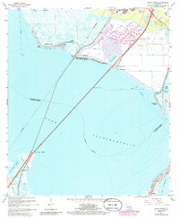
USGS Historical Quadrangle in GeoPDF.
The U.S. Geological Survey, in cooperation with the Massachusetts Office of Coastal Zone Management compiled Massachusetts vector shorelines into an updated dataset for the Office’s Shoreline Change Project. The Shoreline Change Project started in 1989 to identify erosion-prone areas of the Massachusetts coast by compiling a database of historical shoreline positions. Trends of shoreline position over long- and short-term timescales provide information to landowners, managers, and potential buyers about possible future changes to costal resources and infrastructure. This updated dataset strengthens the understanding of shoreline position change in Massachusetts. It includes U.S. Geological Survey vector shorelines...
Categories: Data;
Types: Downloadable,
Map Service,
OGC WFS Layer,
OGC WMS Layer,
Shapefile;
Tags: Atlantic Coast,
Buzzard’s Bay,
Cape Cod Bay,
Coastal and Marine Geology Program,
DSAS,
The Massachusetts Office of Coastal Zone Management launched the Shoreline Change Project in 1989 to identify erosion-prone areas of the coast. The shoreline position and change rate are used to inform management decisions regarding the erosion of coastal resources. In 2001, a 1994 shoreline was added to calculate both long- and short-term shoreline change rates at 40-meter intervals along ocean-facing sections of the Massachusetts coast. In 2013 two oceanfront shorelines for Massachusetts were added using 2008-2009 color aerial orthoimagery and 2007 topographic lidar datasets obtained from NOAA's Ocean Service, Coastal Services Center. This 2018 update includes two new mean high water (MHW) shorelines for the Massachusetts...
Categories: Data;
Types: Downloadable,
Map Service,
OGC WFS Layer,
OGC WMS Layer,
Shapefile;
Tags: Atlantic Coast,
Coastal and Marine Geology Program,
DSAS,
Database IV format,
Digital Shoreline Analysis System,
The Massachusetts Office of Coastal Zone Management launched the Shoreline Change Project in 1989 to identify erosion-prone areas of the coast. The shoreline position and change rate are used to inform management decisions regarding the erosion of coastal resources. In 2001, a shoreline from 1994 was added to calculate both long- and short-term shoreline change rates along ocean-facing sections of the Massachusetts coast. In 2013, two oceanfront shorelines for Massachusetts were added using 2008-9 color aerial orthoimagery and 2007 topographic lidar datasets obtained from the National Oceanic and Atmospheric Administration's Ocean Service, Coastal Services Center. This 2018 data release includes rates that incorporate...
Categories: Data;
Types: Downloadable,
Map Service,
OGC WFS Layer,
OGC WMS Layer,
Shapefile;
Tags: Atlantic Coast,
CMGP,
Coastal and Marine Geology Program,
DSAS,
Digital Shoreline Analysis System,

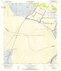
USGS Historical Quadrangle in GeoPDF.
The Massachusetts Office of Coastal Zone Management launched the Shoreline Change Project in 1989 to identify erosion-prone areas of the coast and support local land-use decisions. Trends of shoreline position over long and short-term timescales provide information to landowners, managers, and potential buyers about possible future impacts to coastal resources and infrastructure. In 2001, a 1994 shoreline was added to calculate both long- and short-term shoreline change rates along ocean-facing sections of the Massachusetts coast. In 2013 two oceanfront shorelines for Massachusetts were added using 2008-2009 color aerial orthoimagery and 2007 topographic lidar datasets obtained from NOAA's Ocean Service, Coastal...
Categories: Data;
Types: Downloadable,
Map Service,
OGC WFS Layer,
OGC WMS Layer,
Shapefile;
Tags: Accretion,
Atlantic Coast,
Baseline,
Boston,
CMGP,
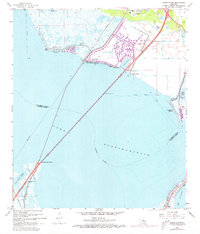
USGS Historical Quadrangle in GeoPDF.
The Massachusetts Office of Coastal Zone Management launched the Shoreline Change Project in 1989 to identify erosion-prone areas of the coast. The shoreline position and change rate are used to inform management decisions regarding the erosion of coastal resources. In 2001, a shoreline from 1994 was added to calculate both long- and short-term shoreline change rates along ocean-facing sections of the Massachusetts coast. In 2013, two oceanfront shorelines for Massachusetts were added using 2008-9 color aerial orthoimagery and 2007 topographic lidar datasets obtained from the National Oceanic and Atmospheric Administration's Ocean Service, Coastal Services Center. This 2018 data release includes rates that incorporate...
Categories: Data;
Types: Downloadable,
Map Service,
OGC WFS Layer,
OGC WMS Layer,
Shapefile;
Tags: Accretion,
Atlantic Coast,
Baseline,
CMGP,
Coastal and Marine Geology Program,
USGS Historical Quadrangle in GeoPDF.
The Massachusetts Office of Coastal Zone Management launched the Shoreline Change Project in 1989 to identify erosion-prone areas of the coast and support local land-use decisions. Trends of shoreline position over long and short-term timescales provide information to landowners, managers, and potential buyers about possible future impacts to coastal resources and infrastructure. In 2001, a 1994 shoreline was added to calculate both long- and short-term shoreline change rates along ocean-facing sections of the Massachusetts coast. In 2013 two oceanfront shorelines for Massachusetts were added using 2008-2009 color aerial orthoimagery and 2007 topographic lidar datasets obtained from NOAA's Ocean Service, Coastal...
Categories: Data;
Types: Downloadable,
Map Service,
OGC WFS Layer,
OGC WMS Layer,
Shapefile;
Tags: Atlantic Coast,
Boston,
CMGP,
Coastal and Marine Geology Program,
DSAS,
USGS Historical Quadrangle in GeoPDF.
The Digital Shoreline Analysis System (DSAS) is a freely available software application that works within the Environmental Systems Research Institute (ESRI) Geographic Information System (ArcGIS) software. DSAS computes rate-of-change statistics for a time series of shoreline vector data. Additionally, the DSAS application is useful for computing rates of change for any boundary-change problem that incorporates a clearly-identified feature position at discrete times, such as glacier limits, river banks, or land use/cover boundaries. The "bias feature" is a shapefile representation the proxy-datum bias (PDB) data previously published in tabular format (Himmelstoss and others 2010, Himmelstoss and others 2018). These...
Categories: Data;
Types: Downloadable,
Map Service,
OGC WFS Layer,
OGC WMS Layer,
Shapefile;
Tags: Atlantic Coast,
Boston,
Buzzard’s Bay,
CMGP,
CSC,
The Massachusetts Office of Coastal Zone Management launched the Shoreline Change Project in 1989 to identify erosion-prone areas of the coast. The shoreline position and change rate are used to inform management decisions regarding the erosion of coastal resources. In 2001, a 1994 shoreline was added to calculate both long- and short-term shoreline change rates at 40-meter intervals along ocean-facing sections of the Massachusetts coast. In 2013 two oceanfront shorelines for Massachusetts were added using 2008-2009 color aerial orthoimagery and 2007 topographic lidar datasets obtained from NOAA's Ocean Service, Coastal Services Center. This 2018 update includes two new mean high water (MHW) shorelines for the Massachusetts...
Problem Perchlorate detected in a shallow supply well within the southern portion of the Locust Valley Water District (LVWD) has prompted interest in determining the possible existence of a deeper confined aquifer (North Shore Aquifer) that may be protected from shallow contamination (fig. 1). Previous USGS studies in this area indicate the northern part of Nassau County has a complex hydrogeologic framework (Stumm and others, 2004). A previously mapped buried glacial valley may extend and be present at this location. If such a buried valley exists, all Cretaceous age deposits (Magothy aquifer, Raritan clay, and Lloyd aquifer) may have been eroded and Pleistocene-aged deposits including the North Shore aquifer...
USGS Historical Quadrangle in GeoPDF.
USGS Historical Quadrangle in GeoPDF.
The Massachusetts Office of Coastal Zone Management launched the Shoreline Change Project in 1989 to identify erosion-prone areas of the coast by compiling a database of historical (mid 1800's-1989) shoreline positions. Trends of shoreline position over long and short-term timescales provide information to landowners, managers, and potential buyers about possible future impacts to coastal resources and infrastructure. In 2001, a 1994 shoreline was added to calculate both long- and short-term shoreline change rates along ocean-facing sections of the Massachusetts coast. In 2013, two oceanfront shorelines for Massachusetts were added using 2008-2009 color aerial orthoimagery and 2007 topographic lidar datasets obtained...
Categories: Data;
Types: Downloadable,
Map Service,
OGC WFS Layer,
OGC WMS Layer,
Shapefile;
Tags: Atlantic Coast,
Baseline,
Boston,
CMGP,
Coastal and Marine Geology Program,
The Massachusetts Office of Coastal Zone Management launched the Shoreline Change Project in 1989 to identify erosion-prone areas of the coast. The shoreline position and change rate are used to inform management decisions regarding the erosion of coastal resources. In 2001, a 1994 shoreline was added to calculate both long- and short-term shoreline change rates at 40-meter intervals along ocean-facing sections of the Massachusetts coast. In 2013 two oceanfront shorelines for Massachusetts were added using 2008-2009 color aerial orthoimagery and 2007 topographic lidar datasets obtained from NOAA's Ocean Service, Coastal Services Center. This 2018 update includes two new mean high water (MHW) shorelines for the Massachusetts...
Categories: Data;
Types: Downloadable,
Map Service,
OGC WFS Layer,
OGC WMS Layer,
Shapefile;
Tags: Atlantic Coast,
Coastal and Marine Geology Program,
DSAS,
Database IV format,
Digital Shoreline Analysis System,
USGS Historical Quadrangle in GeoPDF.
|

|
