USGS Imagery Only Base Map Service from The National Map
Dates
Publication Date
2013
Start Date
2008
End Date
2013
Summary
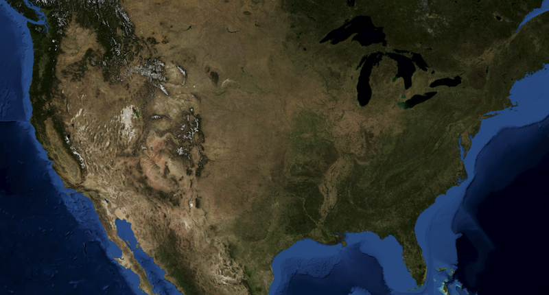
USGS Imagery Only is a tile cache base map of orthoimagery in The National Map visible to the 1:18,000 zoom scale. Orthoimagery data typically are high resolution aerial images that combine the visual attributes of an aerial photograph with the spatial accuracy and reliability of a planimetric map. USGS Digital orthoimage resolution may vary from 6 inches to 1 meter. In the former resolution, every pixel in an orthoimage covers a six inch square of the earth's surface, while in the latter resolution, one meter square is represented by each pixel. Blue Marble: Next Generation and Landsat imagery data sources are displayed at small to medium scales, however, the majority of the imagery service source is from the National Agriculture [...]
Summary
USGS Imagery Only is a tile cache base map of orthoimagery in The National Map visible to the 1:18,000 zoom scale. Orthoimagery data typically are high resolution aerial images that combine the visual attributes of an aerial photograph with the spatial accuracy and reliability of a planimetric map. USGS Digital orthoimage resolution may vary from 6 inches to 1 meter. In the former resolution, every pixel in an orthoimage covers a six inch square of the earth's surface, while in the latter resolution, one meter square is represented by each pixel. Blue Marble: Next Generation and Landsat imagery data sources are displayed at small to medium scales, however, the majority of the imagery service source is from the National Agriculture Imagery Program (NAIP) for the conterminous United States. The data is 1-meter pixel resolution with "leaf-on". Collection of NAIP imagery is administered by the U.S. Department of Agriculture's Farm Service Agency (FSA). In areas where NAIP data is not available other imagery may be acquired through partnerships by the USGS. The National Map Program is working on acquisition of high resolution imagery for the nonconterminous States of Alaska and Hawaii. For the most part, any new Alaska orthoimagery data will not be available in this service due to license restrictions.
This tile cache base map provides a visualization of the free data that is available for download from The National Map at http://viewer.nationalmap.gov/viewer.
Preview Image
Browse graphic showing US representation at small scale.