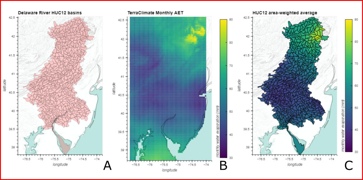
A common workflow in geospatial hydrology is to interpolate geospatial values from one set of polygonal zonal features to another. This can be a computational and time consuming undertaking. This data release provides an easier, faster, and less computationally intensive way, to get a close estimate of the values needed. There are many high value data, for example climatic data, that resides in raster format that are used in countless projects needing information attributed to zonal features such as HUC12 watershed boundaries.. The figure below illustrates such a grid-to-polygon interpolation. A) Huc12 basins for Delaware River Watershed. B) Gridded monthly water evaporation amount (mm) from TerraClimate dataset. C) Area-weighted-average [...]